Mother Nature is getting a jumpstart on a resolution to revive winter in the United States after a recent warm spell and last year’s warmest winter on record.
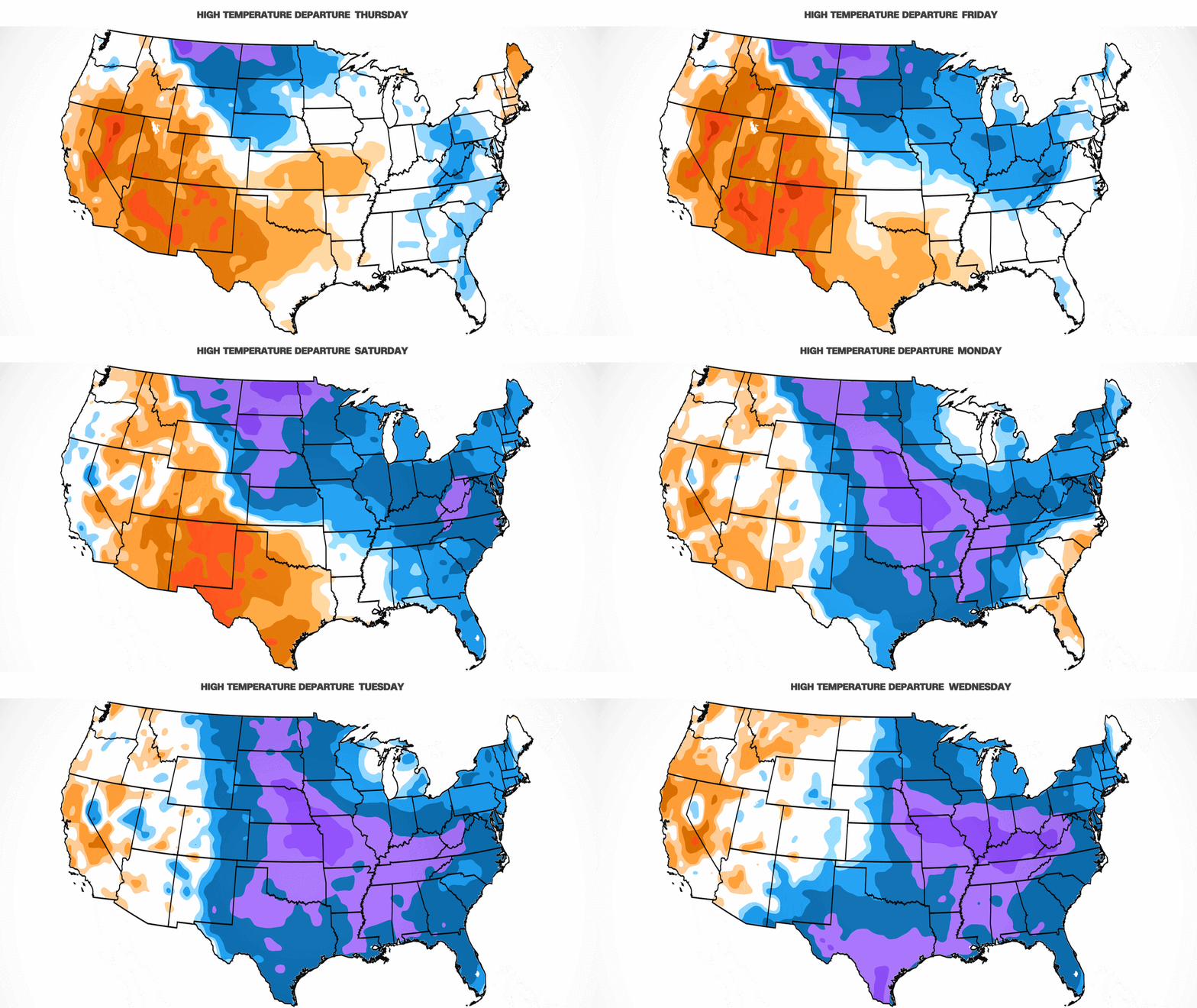
Multiple bursts of increasingly brutal, cold Arctic air will overspread the eastern two-thirds of the country over the next few days, dropping temperatures to dangerous lows by next week.
Temperatures are shaping up to be the coldest of the winter so far and will be frigid even for what’s already typically the coldest time of the year. The cold will be pervasive – more than 70% of the country’s population will experience freezing temperatures over the next week – and stick around well into the month, increasing chances for snow.
The first push of cold air arrived Wednesday for the north-central US and will spread south and east for the remainder of the week and through the weekend. The West will largely miss out on any considerable cold, as has been the trend since at least the fall.

Chicago’s high temperature will be stuck in the low 20s by Friday, which is about 10 degrees colder than normal for early January. High temperatures could hover near the freezing mark in Kansas City, Missouri, St. Louis and Cincinnati.
Low temperatures early Saturday will be downright frigid for millions. Single digit lows will reach Nebraska, Iowa and Illinois while lows could dip to as much as 25 degrees below zero in northern North Dakota.
Breezy conditions for some in the eastern half of the US will make it feel even colder than what the thermometer reads. Dressing for how the air actually feels in the winter – known as wind chill – is critical to prevent frostbite and hypothermia.
People as far southeast as Atlanta and along the Interstate-95 corridor from Raleigh, North Carolina, to Boston will need to prepare for it to feel like the teens on Saturday morning.
Temperatures will be 5 to 20 degrees colder than normal for much of the central and eastern US this weekend, including the Gulf Coast states.
A high in the low 70s is typical for Orlando, Florida, at the beginning of the year but the city may struggle to reach 60 on Saturday.
Next week will be even colder
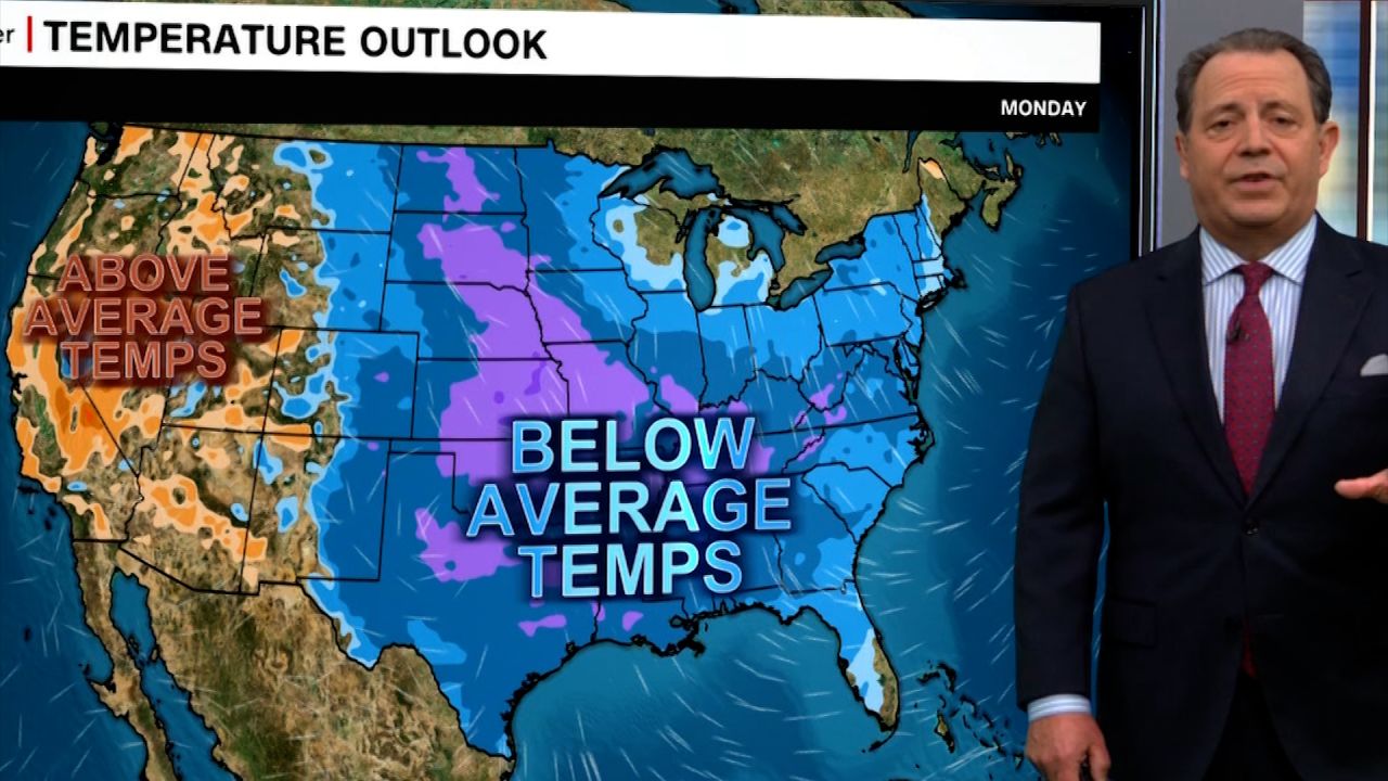
This first batch of cold air through the weekend is just an appetizer. A more brutal blast of bone-chilling air – the coldest of the season – along with dangerous wind chills will push into the central US on Monday and overspread the eastern two-thirds of the country by Tuesday.
Temperatures next week could plummet anywhere from 10 to more than 30 degrees below normal. Frigid wind chills will make the cold dangerous for anyone without access to heat or shelter, especially overnight.
Some of the most significant below average temperatures will occur from the central US to the Southeast. Overnight lows could dip below freezing along the Gulf Coast at times next week. New Orleans doesn’t frequently hit or fall below the freezing mark, but it could reach that threshold next week for the first time since last January.
The abnormal cold could also dip far enough south to wreak havoc on Florida’s highly sensitive citrus crops and cause iguanas to plummet from trees.
The cold is likely to stick around through the second weekend of January. This could leave the atmosphere primed to deliver snow and ice – potentially in places that don’t typically receive it.
Cold doesn’t always mean snow and ice is a guarantee, but a disruptive storm with both is on the way this weekend and early next week. The storm’s exact track, impacts and timing will come into focus by the end of the week, but anyone from the central Plains to the mid-Atlantic should prepare for winter weather.
CNN Meteorologist Monica Garrett contributed to this report.


