Editor’s Note: Our coverage of Hurricane Helene continues here.
Hurricane Helene is now forecast to reach catastrophic Category 4 strength by the time it makes landfall in Florida on Thursday, the National Hurricane Center says, with storm surge potentially climbing to 20 feet along some parts of the coast.
Helene could be the strongest hurricane to hit the United States in over a year – and time is running out for those in its path to prepare.
“A catastrophic and deadly storm surge is likely along portions of the Florida Big Bend coast, where inundation could reach as high as 20 feet above ground level, along with destructive waves,” the center warned. “Preparations to protect life and property should be completed by early Thursday before tropical storm conditions arrive.”
Helene rapidly intensified into a hurricane Wednesday and will continue strengthening as it crosses over the record-warm water of the Gulf of Mexico. Rapidly intensifying storms like Helene are becoming more frequent in a world warming due to fossil fuel pollution.
As of 5 a.m. Thursday, Helene had maximum sustained winds of 90 mph, and it was moving to the northeast at 12 mph, the hurricane center said.
Wind speeds in the storm are expected to reach at least 130 mph by Thursday afternoon, but the hurricane center noted “additional strengthening is possible” in the hours before landfall.
The center of the hurricane – where the most dangerous winds are – is expected to make landfall around Apalachicola on Thursday evening. But its fearsome eye is only part of the story.
Hurricane Helene will grow into a massive, sprawling monster as it tracks north – one that won’t just slam Florida, but also much of the Southeast.
Thousands of Florida residents have already been forced to evacuate and nearly the entire state is under alerts as the storm threatens to unleash flooding rainfall, damaging winds and life-threatening storm surge.
The National Weather Service in Tallahassee described the storm surge threat for Apalachee Bay as “catastrophic and/or potentially unsurvivable” in an update Wednesday.


The hurricane unleashed its fury on parts of Mexico’s Yucátan Peninsula and Cuba Wednesday. Flooding rainfall plunged cars underwater in parts of Mexico’s state of Quintana Roo while powerful ocean waves pounded the coastline. Helene’s strong winds also knocked out power to more than 50,000 people in western Cuba’s province of Pinar del Río.
Areas in Helene’s future track could see worse. The hurricane will be the fourth to make landfall in the US this year and the fifth storm to slam storm-weary Florida since 2022.
“If you’re a godly person, pray, because I don’t really need this,” Port Richey resident Rick Way told CNN affiliate WFTS of the potential flooding Helene could bring. “Neither do any of us.”
But this storm will be different than Hurricane Idalia and other recent storms to strike the state.
Helene is forecast to grow into one of the largest storms in the Gulf of Mexico over the last century, according to hurricane expert Michael Lowry. The hurricane’s wind field could be big enough to stretch from Washington, DC, to Indianapolis. That means more storm surge and more widespread impacts, even with the center of the storm well away from the coast.
“Power outages will likely last days, if not weeks, near where it makes landfall,” the weather service said, also warning of damage to critical infrastructure, widespread inaccessibility and damage to well-built structures.
The storm’s sprawl brought rain and tropical storm-force wind gusts to parts of the Florida Keys Wednesday afternoon and will spread north and east across the state from there, reaching the Tampa area by Wednesday night.
Tropical rainfall and strong gusts could spread over a large portion of the Peninsula by Thursday morning. Hurricane-force wind gusts will follow closely behind for areas along the coast, including in the Tampa area by Thursday night.
Here are the latest developments:
• Storm’s size increases risk of life-threatening storm surge: The Big Bend area faces up to 20 feet, the most serious storm surge threat. Up to 8 feet of surge could inundate Tampa, and threaten high water records in the area, while much of South Florida could get up to 5 feet. Water levels could soar to record heights in Tampa Bay and Clearwater on Thursday night, reaching 1 to 2 feet higher than the records Hurricane Idalia set last year. The threat has forced mandatory evacuations in at least 17 coastal Florida counties.
• Power outage fears in Georgia: The threat of power outages due to Helene will be “significant” and “like nothing we’ve seen,” Georgia Emergency Management and Homeland Security Director James Stallings said Wednesday. Winds and rain from the hurricane will affect the entire state, he said, and with the ground already saturated from a current weather system, trees could topple from the heavy winds, causing major outages.
• Five states under emergency declarations: The governor of Virginia declared a state of emergency Wednesday, joining four other states – Florida, Georgia, North Carolina and South Carolina.
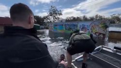
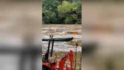
• Rescues in North Carolina: Heavy rainfall has already fueled dangerous flash flooding across several communities in McDowell County, North Carolina, forcing multiple swift water rescues overnight, according to McDowell County Emergency Management. “We urge all residents to avoid unnecessary travel and never attempt to drive through flooded roadways,” county emergency officials said on Facebook, also advising residents near creeks, rivers or low lying areas to “temporarily relocate with family or friends to higher ground until the storm passes and conditions improve.” The flash flooding in McDowell County comes as the region is preparing to face the most serious inland flooding threat from Helene.
• Air travel disruptions: Helene is already causing disruptions in air travel, with more to come as the storm intensifies. More than 800 flights have been canceled for Thursday, according to FlightAware. Most were departing out of Tampa International Airport, which announced it is suspending all commercial and cargo operations on Thursday. Flights out of Fort Myers, Clearwater, Sarasota and Tallahassee are heavily impacted as well.
• Schools and universities shutter: School districts in counties along Florida’s Gulf Coast – including Hillsborough, Pinellas and Sarasota counties – have announced closures through at least Thursday ahead of impacts from Helene. Districts in Georgia, including Atlanta Public Schools, Dekalb County School District and Gwinnett County Public Schools, announced schools would be closed. Several Florida universities likewise announced closures due to the hurricane, including the University of Florida, Florida State University’s Tallahassee campus, University of South Florida, University of Tampa, University of Central Florida and Florida A&M University. And in Georgia, major universities including the University of Georgia, Georgia State University, Georgia Tech and Emory University have also announced that their campuses will be closed, with some stating that classes will be virtual instead.

Helene is huge and threatens the entire Southeast
Coastal areas typically bear the brunt of a hurricane, but that might not be the case with Helene. Tropical alerts span hundreds of miles from South Florida to Tennessee and southern South Carolina because of its size.
Hurricanes typically lose strength quickly once they move over land, where they lose the warm water that feeds them, but Helene will remain more intact well inland because it will be both strong at landfall and moving quickly.
As a result, the storm is forecast to still be a hurricane in Georgia Friday morning, nearly 150 miles from where it makes landfall.
That’s bad news for Tallahassee, Florida, just inland from where the storm is forecast to make landfall. City officials warned Helene “could be the worst storm in the history of the City of Tallahassee.”
“If our community remains central in Helene’s path, as forecasted, we will see unprecedented damage like nothing we have ever experienced before as a community,” Tallahassee mayor John E. Dailey said Wednesday.
The storm is currently forecast to pass just to the west of Tallahassee as a 130 mph Category 4 storm. If it does so, it’ll be the strongest storm on record to track within 30 miles of the city since the late 1800s.
At a news conference Wednesday, Florida Gov. Ron DeSantis urged residents to implement their emergency plans and prepare supplies, but to “not evacuate hundreds of miles” away due to the size and speed of the storm.
The Florida Division of Emergency Management has partnered with Uber to provide free rides to shelters for Floridians in counties with a declared state of emergency, he added.
“Remember, you hide from wind, but you run from the water,” the governor said.
In Hernando County, located along the state’s west-central coast, the county commissioner told residents under evacuation orders to “get out now.”
The county could see up to 12 feet of flooding from storm surge in “the most significant forecast that we’ve come up against,” said Commissioner Brian Hawkins.
“We’re talking about single-story homes that could be completely covered with water if the predictions are true. I can’t stress it enough. I’m asking everybody, please stay safe. Do the right thing, make a plan and evacuate,” Hawkins said.
By Thursday evening, tropical storm-force winds will spread over more of the Southeast and, along with soaking rainfall, could bring down trees and trigger widespread power outages. Atlanta could have wind gusts of 30 to 40 mph during the day Thursday that strengthen to 50 to 60 mph overnight.
Helene’s winds could be “life-threatening” and possibly cause “extensive impacts across portions of central Georgia,” the National Weather Service in Atlanta warned Wednesday.
“This could be an unprecedented event for north and central Georgia given the expected track and strength of Helene.”
Georgia activated its national guardsmen and the state operations center in preparation for the landfall. Residents are being advised to stay off the road as the storm approaches and crews work to clear the roads, Stallings, the state’s emergency management and homeland security director, said.
Helene could produce historic flooding in mountainous areas of the Southeast far removed from the coast. Flooding caused by rainfall has become the deadliest threat of tropical systems in the last decade.
The storm will combine with heavy rain ahead of it Wednesday to raise concerns of “widespread impactful flooding” including “potentially life-threatening flash and urban flooding,” the Weather Prediction Center warned Wednesday.
A level 3 of 4 risk of flooding rainfall is in place Thursday for portions of Florida and Georgia – including Atlanta – Alabama and the Carolinas. A rare level 4 of 4 high risk encompasses a smaller area from northeastern Georgia to the far western Carolinas, where more than a foot of rain could fall through Friday.
The potential for “major to catastrophic flooding” is becoming more likely where the heaviest rain falls, the National Weather Service in Greenville, South Carolina, warned Wednesday.
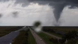
Helene could also produce a tornado anywhere from Florida through much of the Carolinas Thursday.
Ahead of Helene’s threats, Florida’s major theme parks announced closures for Thursday, including a full closure in Busch Gardens, Tampa Bay, Universal Orlando’s Volcano Bay and Disney’s Typhoon Lagoon Water Park.

CNN’s Amy Simonson, Susannah Cullinane, Rebekah Riess, Eric Zerkel, Joe Sutton, Sara Smart, Monica Garrett, Brandon Miller, Gene Norman and Ross Levitt contributed to this report.


