Tropical activity in an unusually active hurricane season will take a breather after Ernesto, but forecasters don’t believe it will last long.
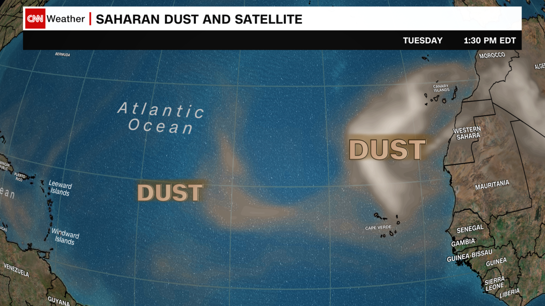
Atlantic storms will be limited for at least the next week. Dry, dusty air and some disruptive winds in the upper atmosphere are making it difficult for stormy weather to get its act together. A similar setup kept the Atlantic quiet for a few weeks following record-breaking Hurricane Beryl.
But this brief break in activity isn’t likely to last nearly as long, according to forecasts from the Climate Prediction Center. Once the dry, dusty air eases, Atlantic tropical activity could be off to the races as stormy weather pushes off the coast of Africa and out to sea unimpeded.

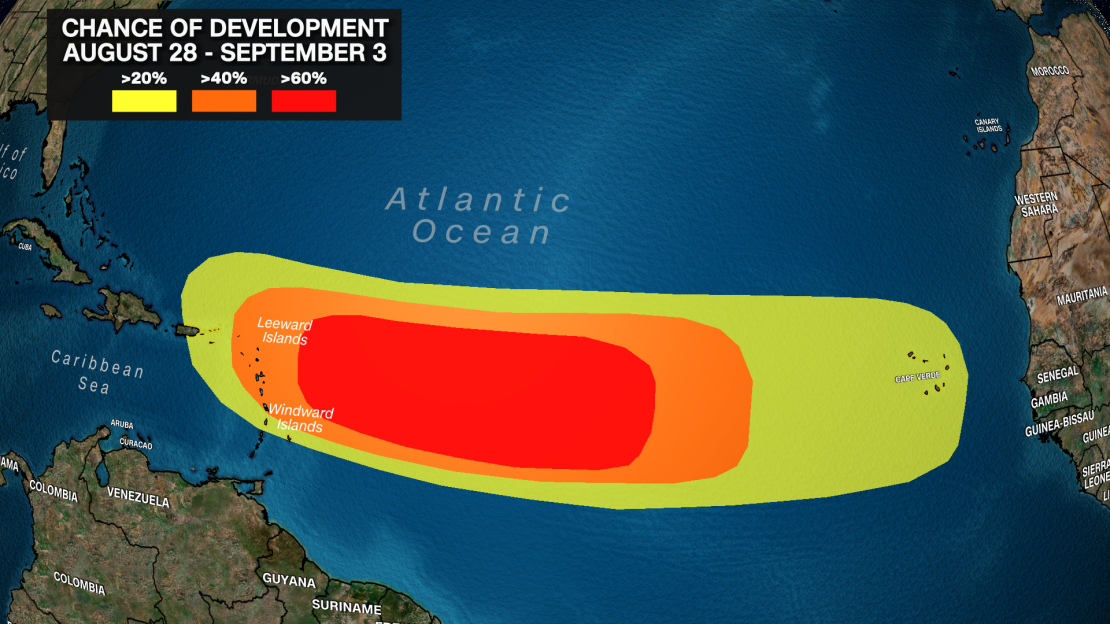
The center’s latest forecast highlights a broad area in the Atlantic from the western coast of Africa to the Caribbean where tropical activity could reignite in late August and early September.
The western tropical Atlantic, just east of the Caribbean, has the greatest chance for development during the same timeframe.

A 40% or greater development chance stretches nearly into mid-September over much of the tropical Atlantic, according to the forecast, so hurricane season might not be hitting the brakes again anytime soon.

This isn’t surprising because the climatological peak of hurricane season is just a few weeks away.
The Atlantic ocean is also still near record-warm, which could help systems develop and potentially explode in strength – something becoming more common in a world warming due to fossil fuel pollution.
Warm water was one of the chief reasons a chorus of expert voices have called for a hyperactive hurricane season, with multiple groups – including NOAA – saying close to two dozen named storms are possible by season’s end.
The season has already been unusually active, producing five named storms – three of which became hurricanes – by mid-August. Ernesto strengthened into the third hurricane of the season almost a month earlier than normal, according to the NHC.
Beryl also shattered expectations when it became the earliest Category 5 hurricane on record in early July. It was a major hurricane – Category 3 or stronger – almost two months ahead of schedule.
These early storms aren’t the only signal of how unusually active the season has been.
This season is the third most active to date since the 1960s, according to one measure of tropical activity used by hurricane experts. Only 2005 and 1980 had a more active start to hurricane season, according to Michael Lowry, a hurricane expert.
The busiest part of hurricane season typically starts in mid-August, peaks around September 10 and persists into mid-October. About 68% of all Atlantic tropical activity typically unfolds after September 1, according to data tracked by researchers at Colorado State University.
This season has already racked up about half of the activity an entire normal season would produce with plenty of tropical activity to come.


