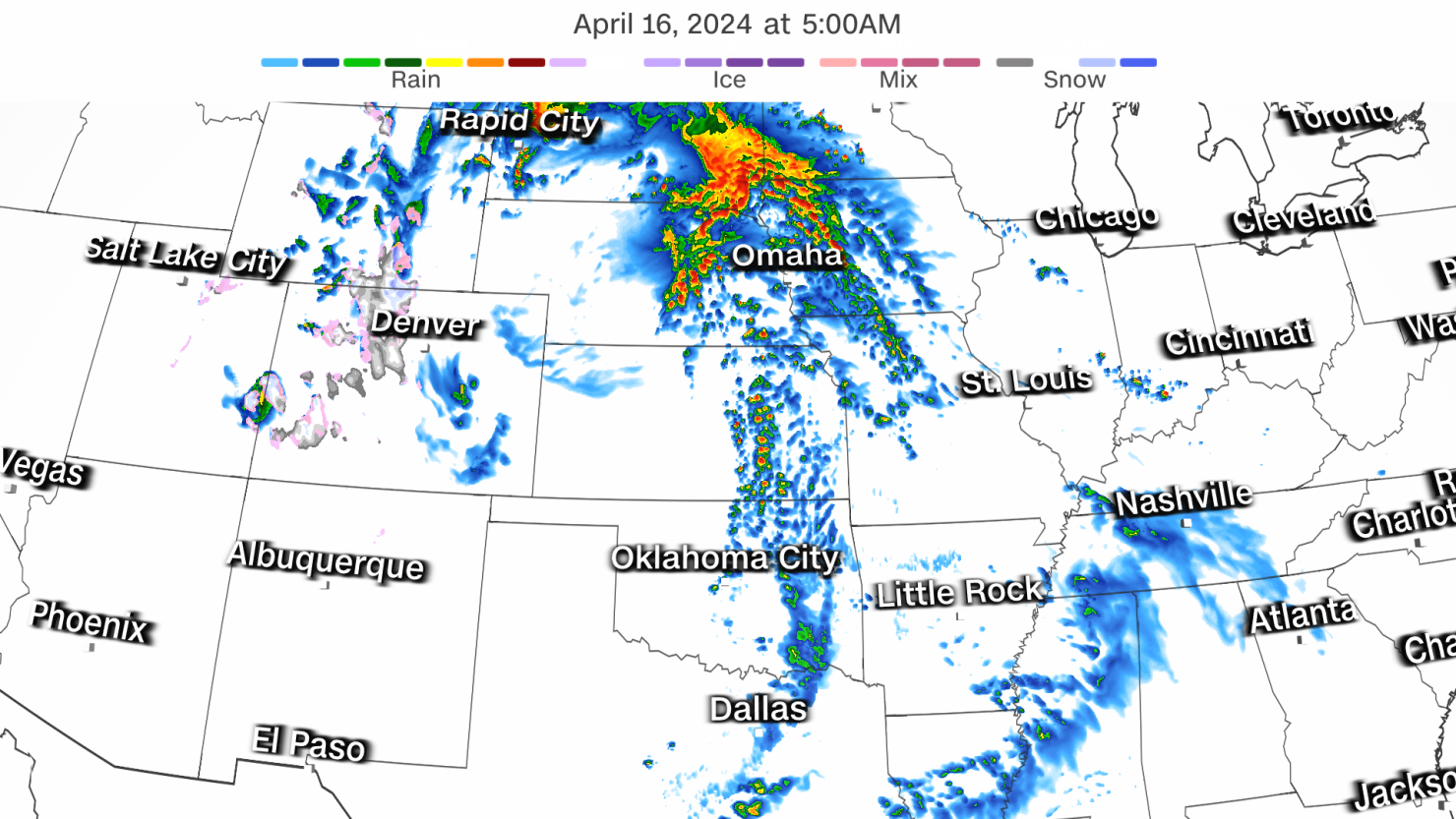
Millions of people in the central US are facing severe thunderstorms early this week that will pack damaging wind gusts, large hail and tornadoes as a wide-reaching storm system strengthens and tracks across the country.
Parts of Nebraska and Kansas are in a Level 3 of 5 risk of severe thunderstorms on Monday, while a larger area from Texas to South Dakota is in a Level 2 risk. Storms are likely to develop in the evening and become stronger and more expansive overnight – making them more dangerous as they could catch people sleeping or unaware. These storms are poised to unload damaging wind gusts, hail and several tornadoes, some of which could be strong.
The Plains states aren’t the only region at risk.
A separate area of potentially punchy thunderstorms fired up in parts of the mid-Atlantic and Ohio Valley Monday afternoon and will persist through much of the evening. Storms could deliver damaging wind gusts and hail from southern Indiana and Kentucky to portions of Virginia, Maryland and North Carolina.
The risk level for parts Virginia and far southern Maryland has increased to a Level 3 of 5 early Monday afternoon, due to the increased likelihood of storms with frequent damaging wind gusts.
An isolated tornado in this region cannot be ruled out.
In the central US, hail nearly the size of baseballs could pummel portions of Texas and areas from Kansas to southern South Dakota.
Storms in parts of Kansas and Nebraska may produce strong tornadoes – EF2-strength or greater – but the threat for tornadoes isn’t limited to those states. Any storm from Texas to South Dakota could churn out a tornado.
The storms most likely to produce tornadoes are expected to develop after dark Monday. This timing makes these storms very dangerous, as research shows nighttime tornadoes are more than twice as deadly as daytime ones.
Nocturnal tornadoes are difficult to spot in the darkness and those sleeping may not be aware danger is near. A charged phone with alerts enabled at full volume is the best way to make sure critical warnings wake you up in time.
The severe thunderstorm threat will shift east on Tuesday. Storms from Monday night will likely be ongoing in portions of the Plains and about to cross into the Mississippi Valley by daybreak Tuesday.
Some of these storms will remain strong as they track into portions of the Midwest through the afternoon. Another round of severe storms may redevelop later Tuesday afternoon in the wake of the morning storms.
A Level 2 of 5 risk is in place Tuesday from Arkansas to Iowa and Wisconsin, with a Level 3 of 5 risk from northeastern Missouri to eastern Iowa and far western Illinois.
Any storm Tuesday could produce damaging wind gusts, hail and tornadoes. But the greatest risk for tornadoes and large hail is found within the Level 3 of 5 risk area.
Heavy rainfall and flooding is also a concern within stormy weather early this week. Portions of the Plains and Midwest could be soaked with 1 to 3 inches of rain from Monday through Tuesday.
Milwaukee, Wisconsin, and Fort Wayne, Indiana, are already dealing with a surplus of rain this month, with more than a dozen river gauges already at minor flood stage even before the next round of rain arrives.
Additional rainfall may cause river levels to rise further or lead to instances of flash flooding.
The severe thunderstorm threat will persist Wednesday as the storm system tracks east. Storms with damaging winds, hail and tornadoes could unfold over additional parts of the Midwest and portions of the Tennessee Valley during the afternoon and early evening hours.
CNN’s Robert Shackelford and Elizabeth Wolfe contributed to this report.


