Editor’s Note: A version of this article originally appeared in the weekly weather newsletter, the CNN Weather Brief, which is released every Monday. You can sign up here to receive them every week and during significant storms.
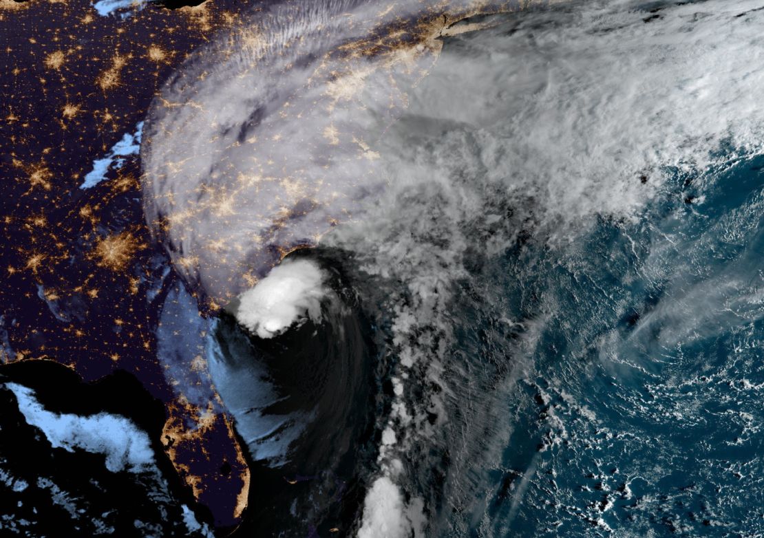
Ian is no longer a normal hurricane. It is more of a hybrid, combining a hurricane with a typical storm system, and it is already lashing the Georgia and Carolina coasts with ferocious winds and rainfall.
“Ian is caught between quickly intensifying over the warm Gulf Stream water and being killed by a cold front,” CNN meteorologist Chad Myers says.
This is the same front keeping everyone in the eastern US cooler than normal.

“That battle will continue until landfall,” he adds. “As you look at the radar, Ian looks like it has fronts and not a circular eye. That is why the current Ian is so unusual.”
“The motion of Ian’s center has been somewhat discontinuous during the past 6 to 12 hours, with multiple swirls, apparently rotating around a common center,” the National Hurricane Center said.

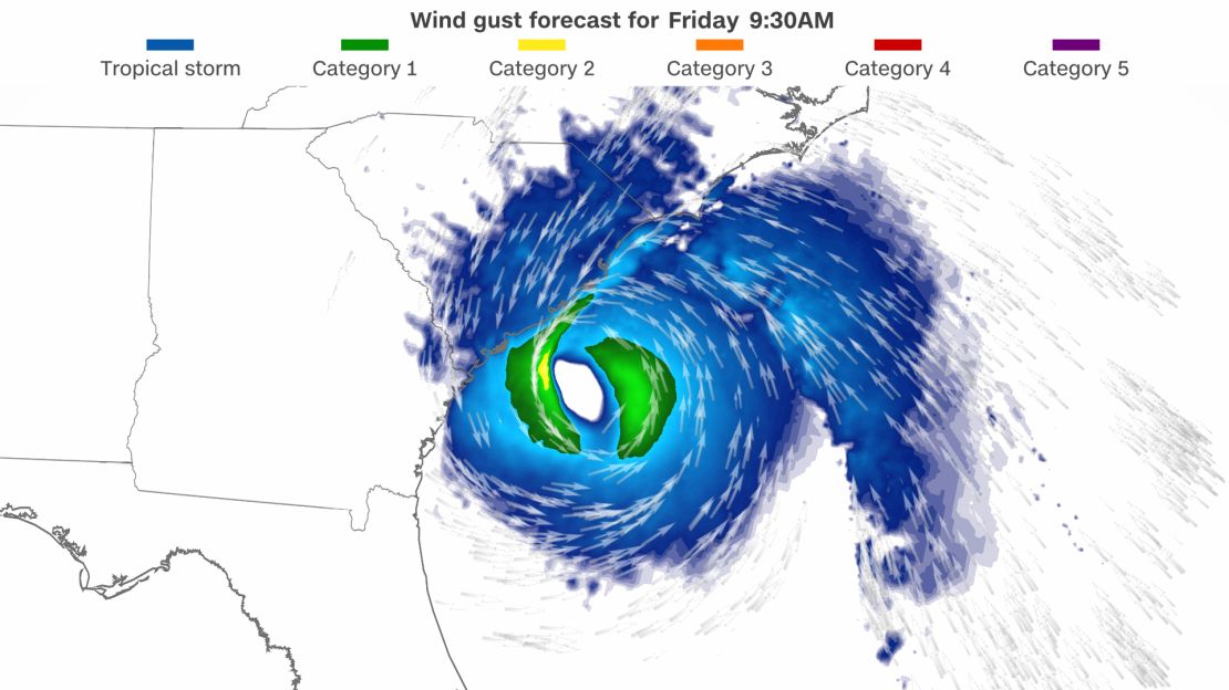
What this means is that it will keep the storm from strengthening more but also that hurricane-force winds will stretch further along the coast, and cities like Charleston and Myrtle Beach will still feel these winds, even if it doesn’t make landfall directly over them.
There isn’t going to be this massive eyewall, or area of extreme turbulence immediately surrounding the eye, of the worst winds. Instead, the Category 1 winds extend 70 miles from the center and tropical storm-force winds extend outward up to 485 miles.
And the strongest winds, which generally occur on the storm’s right side, are actually on the left side right now.
The hurricane is expected to make landfall between Charleston and Myrtle Beach Friday afternoon.
Here is what else to expect …
Storm surge
Ian’s exact landfall position only matters regarding where the storm surge will occur.
“The deepest water will occur along the immediate coast near and to the right of the center, where the surge will be accompanied by large waves,” the National Hurricane Center says.
In South Carolina, from Edisto Beach to Little River Inlet, 4 to 7 feet of surge could occur. The surge on the East Coast of the US largely depends on the tide cycle.
It drastically changes – more than on the Gulf Coast – so a surge happening at high tide is much worse than one occurring at low tide.
Right now, most of the high tides are forecast for later this morning, right around the time the center of Ian makes its approach on the coast.
So, “as tides continue to rise this morning and rainfall rates continue to increase, flash flooding will begin,” the National Weather Service said.
Rainfall
Bands of heavy rain will continue to move inland over the Charleston metropolitan area this morning. So far, 1 to 2 inches of rain has already fallen, with an additional 2 to 6 inches expected.
A flash flood warning is in place for the Charleston metro area until noon ET. According to the National Weather Service in Charleston, considerable flash flooding is expected from Ian’s heavy rainfall this morning.
Some locations that will experience flash flooding include North Charleston, downtown Charleston, the I-26/I-526 interchange and the Charleston Naval Complex.
Although Ian will weaken significantly after landfall, the extreme rains will surge further inland.
This heavy rainfall will spread all the way into southwest Virginia. The Weather Prediction Center has issued a level 3 of 4 for extreme rains for portions of South Carolina, North Carolina and Virginia.
The worst rainfall will fall near the center of the storm and to the north of the storm track.
To the south of the storm, dry air will filter in and keep areas free from the extreme rains.


