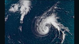
Hurricane Olivia, a storm with sustained winds of 80 mph, is churning toward Hawaii and could affect the island chain as early as Tuesday evening.
Now a Category 1 storm, Olivia was about 825 miles east northeast of Hilo, Hawaii as of 11 p.m. local time Saturday (5 a.m. Sunday ET), the Central Pacific Hurricane Center said.
The storm may be near the Hawaiian Islands late Tuesday, the center said, warning that tropical storm or hurricane watches could need to be issued Sunday.
“Little change in strength is forecast during the next couple of days, and Olivia is expected to remain a hurricane through Monday evening. Some gradual weakening is possible on Tuesday, but Olivia will likely remain a threat to the Hawaiian Islands next week,” the hurricane center said.

“While it is too soon to determine the location and magnitude of the worst impacts, all interests in Hawaii should continue to monitor the progress of Olivia, and use this time to prepare for the increasing likelihood of direct impacts from this system early next week,” the center warned.

Olivia would be the second tropical system to hit the Hawaiian Islands this year. Hurricane Lane dropped more than 50 inches of rain across the Big Island last month.
The storm was the second-wettest tropical system to affect the United States and the wettest tropical system on record in Hawaii, surpassing Hurricane Hiki in 1950.
Some rain from Olivia could help Hawaii, nearly one-third of which is experiencing a moderate drought, according to the drought monitor released Thursday by the National Oceanic and Atmospheric Administration.
But flash flooding could be a concern.


