June 20, 2024: US heat wave news | CNN

June 20, 2024: US heat wave news

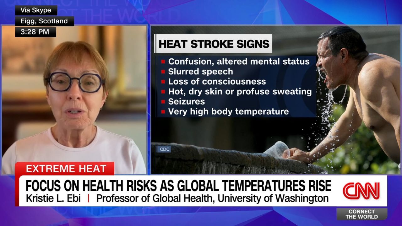
<p>From New York to India, temperatures are soaring to dangerous levels across the globe. Kristie L Ebi, Professor of Global Health at the University of Washington, walks through the signs of heat stroke and steps that should be taken to stay safe this summer.</p>
How to stay safe in extreme high temperatures
04:03 - Source: CNN

Here's what we covered here

37 Posts

Some Texas cities saw nearly 3 times their June average for rainfall because of Alberto 

Some Texas communities saw nearly three times their June average for rainfall over 48 hours from Tropical Storm Alberto this week, according to the National Weather Service office in Corpus Christi.  

The Gulf Coast-area city of Rockport, Texas, received 9.97 inches of rain from the storm, and its June average is 3.66 inches, according to the office. Alice, Texas, situated west of Corpus Christi, received 6.57 inches of rain – nearly triple its June average of 2.32 inches. 

Some other notable rainfall totals in Texas, according to the weather service in Corpus Christi:

Fulton: 8.30 inches 

Woodsboro: 7.46 inches 

Sinton: 7.00 inches 

Kingsville: 5.37 inches 

Corpus Christi: 5.09 inches 

South Texas will continue to see scattered thunderstorms Friday, but rainfall totals from now through Friday evening should be below 1 inch, according to the weather service. The area still faces a flooding threat Friday because of heavy rain from the past two days. 

Coastal flood alerts are in effect through coastal Texas, Louisiana, and Mississippi because of high water levels along the coastlines from strong winds. 

“With a continued long period swell overnight into Friday morning as well as slightly higher predicted tides, water levels above normal conditions should once again range from 2.5 to 2.75 feet,” the weather service office for Brownsville and the Rio Grande Valley said Thursday.

In pictures: Dangerous heat, wildfires and storms across the U.S.

Dangerously hot temperatures are scorching the Midwest and Northeast, the result of a record-breaking heat wave. Scientists have warned that heat waves will become more frequent and more severe as the climate crisis intensifies.

In the West, wildfires in New Mexico have killed at least two and unleashed a torrent of flash flooding. In California, the Post Fire north of Los Angeles, has grown to more than 15,000 acres in size and has forced the evacuation of hundreds of people.

Tropical depression Alberto, the first named storm of the 2024 Atlantic season, made landfall in Mexico on Thursday. The storm has brought heavy rain and flood threats to parts of the country.

Government employees remove a fallen tree from the roadway as tropical storm Alberto hits, in Monterrey, Mexico on June 20.
The Santa Catarina river, as tropical storm Alberto hits Monterrey, Mexico on June 20.
People buy fans in Chinatown during a heatwave affecting New York City on June 20.
A man is attended to after fainting in the heat outside the Supreme Court in Washington, DC on June 20.
Eddie Hogan wipes sweat from his head, while he works out outdoors during a heat wave in New York City on June 20.
A bird flies past a palm tree standing in front of the downtown Los Angeles, California skyline obscured by haze following a wildfire north of the city on June 20.
Bobby Smith, the property manager of the River Ranch RV Park, empties water out of a guitar after the property was damaged from a flash flood in the aftermath of the fires in Ruidoso Downs, New Mexico, on June 20.

Numerous daily temperature records broken in New England

Several daily temperature records were set in New England today.  

Manchester, New Hampshire, reached 99 degrees Fahrenheit, setting a daily record and coming up just one degree shy of its June record. It was the third consecutive day in which the city set a record. Each day was 97 degrees or higher and the normal high for the date is just 80 degrees.

Other daily records tied or broken on Thursday include:

  • Hartford, Connecticut, reached 98 degrees. The old record was 97 degrees in 2012.
  • Augusta, Maine, reached 97 degrees. The old record was 95 degrees in 1953.
  • Bangor, Maine, reached 96 degrees. The old record was 95 degrees in 1931.
  • Portland, Maine, reached 94 degrees. The old record was 93 degrees in 2020.
  • Scranton, Pennsylvania, reached 95 degrees, which was a tie with the 1953 record.

Northern New England will finally get a break Friday as temperatures across much of northern New York, Vermont, New Hampshire and Maine will top out in the 70s and low 80s.

Only a few scattered daily temperature records are expected in the Ohio Valley and Mid-Atlantic Friday, but temperatures will remain 10 to 15 degrees above normal, reaching the low to mid-90s.

The heat continues to increase and expand southward over the weekend with widespread upper 90s and even triple digits possible around Washington, DC. If the nation’s capital reaches the century mark, it will be the first time since August 2016.

FBI investigating origins of deadly fires in Ruidoso, New Mexico

Structures that were destroyed in the Village of Ruidoso, New Mexico, are photographed on June 19.

FBI special agents have joined the investigation into the cause of wildfires in New Mexico that claimed at least two lives and destroyed over a thousand structures, the agency said Thursday.

Amtrak and NJ Transit rail services restored after suspensions, companies say

Commuters wait for an Amtrak train Moynihan Train Hall at Penn Station, in New York, on June 18.

Amtrak said power has been restored and rail service has resumed between Philadelphia and New Haven, Connecticut, after portions of the rail service were suspended due to power issues and a brush fire. 

New Jersey Transit’s rail service has also resumed in and out of New York’s Penn Station, with delays of up to 90 minutes, the transit company said in a statement.

“It kept getting hotter and hotter.” Amtrak passenger stuck on train without A/C during suspension 

Josh Winston was on Amtrak’s Northeast Regional 85 train from Boston to Virginia when the power suddenly went out and the train came to a stop around 2 p.m. ET.

The 24-year-old said the train got stuck roughly 20 minutes outside Penn Station, where it would stay until around 4 p.m. ET.

Portions of Amtrak and New Jersey Transit rail service were suspended due to power issues and a brush fire in the Secaucus, NJ area, transit officials said. The suspension comes as a heat wave is scorching parts of the Midwest and Northeast.

Winston said when the power went out, so did the air conditioning.

“Everybody was pretty sweaty. I think, you know, it got quite hot — probably over 90 degrees by the time we were finally moving again. I was dripping quite a bit of sweat, unfortunately,” he told CNN. 

Though the train was headed to Virginia, his plan was always to get off at Penn Station. The train was suspended after they reached New York, so everyone had to get off there, he said. 

DC’s metro rail system implements above-ground speed restriction due to heat

Washington, DC’s metro rail system has implemented speed restrictions due to extreme heat Thursday afternoon.

Extreme heat can expand the rails the trains run on, WMATA said.

Saturday is set to be the first 100-degree day in DC since August 2016 and the first 100-degree day in June since 2012, according to CNN Weather. 

The Metropolitan Transportation Authority, North America’s largest public transportation agency, said earlier this week it is reducing the speeds of some New York trains during the prolonged heat. 

##Heat Wave## 

Portions of Amtrak and NJ Transit train services suspended due to power issues and brush fire, officials say

As a heat wave bakes the Northeast, portions of the Amtrak and New Jersey Transit rail services have been suspended during rush hour due to power issues and a brush fire, transit officials said.

The Amtrak service is disrupted between Philadelphia and New Haven, Connecticut, a spokesperson said.

NJ Transit posted on social media that “rail service is suspended into and out of Penn Station New York due to AMTRAK overhead wire issues in Penn Station New York. Midtown Direct trains are being diverted to Hoboken.”

Passenger Josh Winston, 24, told CNN his train was delayed for 2 hours and a diesel train was forced to tow it into Penn Station.

While the brush fire is out, NJ Transit called it “significant” in a social media post, noting it was impacting wire repairs.

The suspensions come as a massive heat wave is scorching parts of the Midwest and Northeast, where record-breaking high temperatures are forecast across dozens of cities. 

##Heat Wave## 

NYC heat stretch could break record for June

People walk along Brooklyn Bridge Park on June 19 in New York City.

New York City could experience 90-degree temperatures or higher for each of the next seven days. If this occurs over the next week, it would tie the longest stretch in a decade and would be the longest stretch ever in June.

The forecast of 94 degrees for Central Park on Friday would mark the highest temperature there since July 2022.

The heat index in New York City will be up to and even exceeding 100 degrees Friday. Meanwhile, much of the area will be under heat advisory beginning Friday afternoon except Long Island and parts of the city nearest the water.

Air quality alerts for ground level ozone are in effect until 11 p.m. ET Thursday, furthering health dangers from the heat.

Biden "closely monitoring" New Mexico wildfires, White House says

An airtanker drops fire retardant over the Salt fire as it nears the town of Ruidoso, New Mexico, on June 19. 

President Joe Biden is “closely monitoring” wildfires in New Mexico, the White House said Thursday.

The administration has also approved an expedited major disaster declaration from New Mexico Gov. Michelle Lujan Grisham, “unlocking further federal support and FEMA assistance to the impacted communities.” 

The official said more than 800 federal personnel are helping fight the fires and the US Forest Service is leading the operation.

Heat degrading air quality in parts of Northeast and Midwest

Large swaths of the Midwest and Northeast are forecasted to have air quality “unhealthy for sensitive groups” Thursday and into Friday, according to data from AirNow.gov.  

Parts of Indiana, Kentucky, Ohio, Michigan, Pennsylvania, New Jersey, New York, Connecticut, Massachusetts and Rhode Island have forecasted AQI index values of 101 to 150 on Thursday, meaning members of sensitive groups may experience health effects. 

Some context: Heat worsens ozone and other types of air pollution, deteriorating air quality on hot days. The same abundant sunshine that heats up the air to roasting levels during a heat wave also reacts with pollutants found in the air near the Earth’s surface.

Sunshine and pollutants — like those emitted by cars, power plants, other industrial practices and more — undergo a chemical reaction that creates ozone, which is typically what reduces air quality most on a hot day.

Ozone impacts the lungs, which makes it hard to breathe when levels are elevated.

CNN’s Mary Gilbert contributed to this report.

Dangerous heat, deadly wildfires and storms: Here's the latest on weather across the US

A heat wave unlike any seen in decades is sweeping large parts of the United States, which is also grappling with deadly wildfires, storms and severe flooding in some areas.

The first named storm of the 2024 Atlantic Hurricane season, now-Tropical Depression Alberto, has been wreaking havoc in northeast Mexico and southern Texas with destructive coastal floodingstrong winds and heavy rains extending hundreds of miles from its center.

President Joe Biden has been briefed on the extreme heat, wildfires and Alberto, the White House said.

Here’s where things stand:

  • Wildfires: Within 24 hours, two fires raging in southern New Mexico have killed at least two people, damaged 1,400 structures and forced the evacuation of more than 8,000 residents. Fresh precipitation Thursday will help douse wildfires, but will also create new hazards — particularly the threat of perilous flooding, according to a New Mexico State Forestry Division official. A dust storm, also known as a haboob, set off by winds flowing outward from thunderstorms, also created hazardous conditions late Wednesday.
  • Tropical Storm Alberto made landfall on Thursday near Tampico, Mexico, according to the National Hurricane Center. Three minors have died as a result of heavy rains in Mexico’s Nuevo León state, Gov. Samuel García said Wednesday night. The storm has since been downgraded to a tropical depression as it tracks through central Mexico, according to the National Hurricane Center.
  • In Texas: Tropical storm warnings have been discontinued along the Texas coast, according to the NHC. But the storm’s massive sprawl of strong winds is still pushing water from the Gulf of Mexico onshore in southern Texas. Looking ahead, the tropics will stay active after Alberto with more storms possible in the coming days.
  • Extreme heat: 94 million Americans are under extreme heat advisories, watches, and warnings today, according to the National Weather Service. The heat wave has been baking the Midwest, Great Lakes and Northeast. Over 40,000 Michigan customers are without power Thursday following storms Wednesday night. Washington, DC, could hit 100 degrees for the first time since 2016 this weekend, forecasts show.
  • Link to climate crisis: The world consumed record amounts of oil, coal, and gas last year, pushing planet-heating carbon pollution to a new high, according to a new report. Climate change is worsening global extreme weather in general, but much of that change is related to heat. Heat fuels other types of extreme weather by adding moisture to the atmosphere, making events like heavy rainfall and floods more intense.

Severe thunderstorm watch issued for sweltering New England

A severe thunderstorm watch has been issued by the Storm Prediction Center for more than 7 million people across parts of New England that have endured record-breaking temperatures in recent days.

Any storms moving through the area could have damaging winds up to 70 mph and up to quarter-sized hail, the SPC said.

The storms will fire up this afternoon thanks to a cold front that will traverse the region and finally end the oppressive heat. Temperatures were in the 90s when the severe thunderstorm watch was issued, with the heat index — what heat feels like to the body — is topping 100 degrees.

Temperatures will plunge into the low 70s once the storms and the cold front move through.

Crews conduct welfare checks in flooded Corpus Christi, Texas

Members of Texas A&M Task Force 1 conduct welfare checks in Corpus Christi, Texas, on Thursday.

Search and rescue crew Texas A&M Task Force 1 rolled through the North Beach community of Corpus Christi, Texas, today with a high-water vehicle and trucks pulling boats.

The team was conducting welfare checks as requested by city officials, according to Merribeth Kahlich, the team’s assistant public information officer.

No rescues had been conducted as of midday, Kahlich said. A CNN team observed one woman being transported out of the area in a high-water vehicle.

A storm surge of 3.5 feet was reported in Corpus Christi this morning – more than a foot higher than levels reported at the same time yesterday, data from the National Oceanic and Atmospheric Administration shows. The levels remained high during the afternoon as high tide arrived.

These satellites images show the devastation of the New Mexico wildfires

Homes damaged by the South Fork Fire in Ruidoso, New Mexico.

New satellite imagery from Maxar Technologies shows the burn scar and devastation from fires in Ruidoso, New Mexico. 

Fires are still burning around the village, and a number of homes and structures in the town itself have been completely destroyed. 

At least two people have died in the fires, and at least another two were injured.

Wildfires burn near Ruidoso, New Mexico, on June 19.
Homes damaged by the South Fork Fire in Ruidoso, New Mexico.
Wildfires burn near Ruidoso, New Mexico, on June 19.

Thousands under heat advisories in Michigan are without power after storms

Over 40,000 Michigan customers, many of whom remain under heat advisories, are without power Thursday following storms Wednesday night.

At least 41,733 Michiganders are without power as of 11 a.m. ET, according to PowerOutage.us

“Strong storms moved through Michigan yesterday evening causing outages for our customers,” DTE Energy, one of the power companies serving Michigan, said in a statement on its website. 

DTE Energy estimated 75% of customers will have restored power by the end of the day. 

The power outages come as swaths of southern Michigan remain under heat advisories Thursday, according to the National Weather Service. The service warned more showers and storms could bring torrential downpours and gusty winds this afternoon and evening. 

Temperatures will run up to 10 degrees above average in the impacted areas Thursday and Friday.

Some parts of the state, including Ann Arbor and Detroit, are also forecasted to have air quality that’s unhealthy for sensitive groups Thursday. 

CNN’s Eric Zerkel contributed to this report.

Watch storm surge inundate Texas town in dramatic drone video

Waves crashed over a sea wall this morning as the storm surge from Alberto flooded the coastal town of Surfside Beach in coastal Texas.

Water surrounded rows and rows of homes, as seen in dramatic drone footage this morning.

27d04947-b7f4-4e5c-8a63-e579ce8c7b6f.mp4
00:27 - Source: cnn

The video in this post is courtesy WxChasing / LSM.

Alberto now a tropical depression as it cuts through Mexico

Tropical Depression Alberto is seen over Mexico on Thursday morning.

Alberto is now a 35 mph tropical depression tracking through central Mexico, according to the National Hurricane Center.

The storm was located about 95 miles west of Tampico, Mexico, where it made landfall earlier Thursday morning as a tropical storm.

The storm will continue to lose its windy punch as it moves through Mexico and is forecast to fizzle over central parts of the country.

But its dangerous rain will continue, and several more inches could fall over Central Mexico, according to the NHC.

President Biden briefed on Alberto, wildfires and extreme heat

Floodwater flows through a neighborhood on June 20, in Jamaica Beach, Texas.

President Joe Biden has been briefed on extreme heat across the country, wildfires in the western US, and Alberto as the first named storm of the 2024 Atlantic hurricane season, which made landfall in Mexico, the White House said. 

“The President has been briefed on Tropical Storm Alberto and its impacts in Texas and New Mexico, and he is being regularly updated on the ongoing wildfires in New Mexico and California and the actions that FEMA, the U.S. Forest Service, and the Department of Interior Bureau of Indian Affairs are taking in response to the needs of impacted New Mexico communities,” a White House official said. 

“The President has also been briefed on the extreme heat affecting communities nationwide,” the official added. The dangerous heatwave is hitting parts of the Midwest and Northeast.

Biden is in Rehoboth Beach, Delaware, today before he travels to Camp David for intensive debate prep sessions. The high in Rehoboth Beach is 79 degrees, compared to 91 degrees in Washington, DC, where it could hit 100 degrees this weekend. 

Rain in New Mexico will help fight wildfires — and also cause new dangers, official says

Damaged foliage is seen in front of a car destroyed by wildfires in Alto, New Mexico, on June 19.

Fresh precipitation Thursday will help douse wildfires that have torched more than 35 square miles of New Mexico and killed at least two people. 

But that same rainfall will create new hazards for first responders and residents – particularly the threat of perilous flooding, said George Ducker, wildfire prevention and communications coordinator for the New Mexico State Forestry Division.

As of Thursday morning, a pair of wildfires that have scorched about 23,000 acres were still 0% contained, Ducker said.  

The threat of mud and flooding “is present for pretty much anywhere where we’re getting more than moderate rain or flash rain,” Decker said.  

“The conditions are not good for responders,” he said. “What we’re asking is that folks just try to steer clear of the area – stay out of the area.”