
Dangerously cold conditions will impact over 60 million Americans between Wednesday and the weekend spanning a large swath of the US and setting the stage for widespread disruptions from a winter storm.
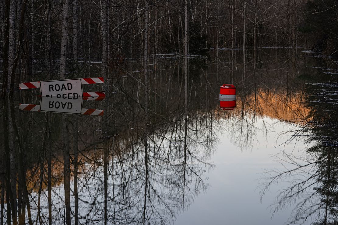
Arctic air is interacting with a strengthening storm system to bring hazardous winter weather to the central US, which will eventually reach the mid-Atlantic coast. The bitter cold and snow will also complicate recovery efforts in parts of Kentucky, West Virginia and Virginia, where communities are still reeling from deadly floods caused by a storm over the weekend.
At least 15 people have died from last weekend’s storm, including two in West Virginia and 12 in Kentucky. One person remained missing in the storm’s aftermath in West Virginia Tuesday morning, according to Gov. Patrick Morrisey. Two others appeared to have died from hypothermia in Kentucky’s Jefferson County, Gov. Andy Beshear said at a Tuesday morning news conference.
“That should tell all of us the weather conditions are as dangerous as that water is,” Beshear said, referring to the ongoing brutal cold and snow coming to the state.
The cold air will get more intense and expansive throughout the week and about three-quarters of the US population is expected to experience below-freezing conditions by Friday.
Temperatures will plunge as much as 50 degrees below February averages, with more than 270 temperature records across at least 27 states.
Snow headed for flooded areas in Kentucky and West Virginia
February has been an intensively active month for disruptive and deadly winter storms in the US, and the pattern isn’t over yet.
A new winter storm will dump 3 to 6 inches of snow over much of flooded Kentucky and more than 6 inches in parts of West Virginia, complicating the post-storm cleanup process.
Crews in Kentucky and West Virginia were racing against the clock to complete flood rescues ahead of the dangerous wintry weather. Since the flooding began, emergency crews from the Kentucky National Guard and Kentucky State Police have conducted more than 1,000 rescues, Beshear said.
At least 60 rescues had taken place across southern West Virginia which was hardest-hit by the flooding, Gov. Patrick Morrisey said Tuesday.
There was hope water rescues would ebb Wednesday in Kentucky and allow crews to reset and prepare for winter weather, Eric Gibson, director of the Kentucky Division of Emergency Management, said Tuesday.
“The Kentucky National Guard is transitioning from life-saving missions to recovery efforts focused on debris removal, restoring access and transporting supplies to affected communities,” Gov. Beshear said in press conference Tuesday.
Power restoration efforts are continuing in the state and just over 4,000 customers remain without power, according to Poweroutage.us. Still, some people with power but damaged equipment might not have safe access to heat, Beshear said Tuesday.
“If you cannot safely power your home by the middle of today, you need to be looking at a shelter option,” Beshear urged. “You need to make sure you’re safe.”
Wind chills are expected to reach the single digits in most of Kentucky Wednesday morning and air temperatures will be stuck below freezing through Friday in most areas.
Life-threatening cold expands to the Plains and the Gulf
The coldest air of winter started to work its way into the northern US early this week and will expand rapidly across the Southern Plains and along the Gulf Coast in the coming days.
Wind chill temperatures reached a life-threatening nearly 60 degrees below zero in parts of Montana and North Dakota Tuesday morning. Tuesday was the coldest it’s been in Bismarck, North Dakota, in more than 16 years. Below zero wind chills extended as far south as Oklahoma and the Texas Panhandle.
In South Dakota, Sioux Falls reached a high temperature of -1 degrees on Tuesday, breaking the daily record for the cold high for February 18th. The previous record was 3 degrees, set in 1901.
In Hastings, Nebraska, a high temperature of -2 degrees was recorded on Tuesday, which shattered the previous cold high of February 18 of 5 degrees in 1993. The average for the city is 41 degrees.
Oklahoma City dropped below freezing early Tuesday and will continue to stay below freezing until Saturday morning. The city will likely break numerous cold records by the end of the week.
In Kansas City, which typically records a high of 45 degrees in February, temperatures dropped to single digits Monday evening and will not reach 10 degrees again until Thursday afternoon. Temperatures will not top the freezing mark until Saturday afternoon.
Dallas has an expected high temperature below freezing on Wednesday, running over 30 degrees below their average of 61 degrees this time of year.
The cold will spread to the Southeast as the end of the week approaches.
Snow and ice caused significant travel issues by Tuesday afternoon in parts of Oklahoma. Interstate 44 was shut down in both directions in the northeast part of the state and into far western Missouri.
States of emergency were in effect for Arkansas, North Carolina and Virginia due to the storm.
Parts of Kansas, Oklahoma, Missouri and Arkansas could receive more than a foot of snow Tuesday into Wednesday, including Springfield, Missouri, which would be its most snow in nearly 20 years. Major impacts from the storm are expected in this region, including dangerous to impossible driving conditions, according to NOAA’s Winter Storm Severity Index.
Memphis could record 1 to 3 inches of snow and sleet, and also some ice, while Nashville could get up to 3 inches of mainly snow. Flood alerts are still in place for area rivers, including the Mississippi and Cumberland.
Snow will also fall in Virginia, where flood alerts remain active for the James River. It will be heaviest closest to the Atlantic coast. Virginia Beach is forecast to receive 10 inches of snow, which would be its most since 1980.
Dangerous cold will expand over the country while the winter storm tracks east through midweek.
Wind chills will make the cold even more dangerous. In the Northern Plains, wind chills are expected to range from 30 to 60 degrees below zero, creating risks of frostbite within minutes of exposure.
Gusty winds will push wind chills below zero as far south as Texas and Arkansas by midweek, while single-digit wind chills are expected in parts of Tennessee and Kentucky toward the end of the week.
CNN Meteorologist Brandon Miller and CNN’s Rebekah Riess, Amanda Musa and Lauren Mascarenhas contributed to this report.

