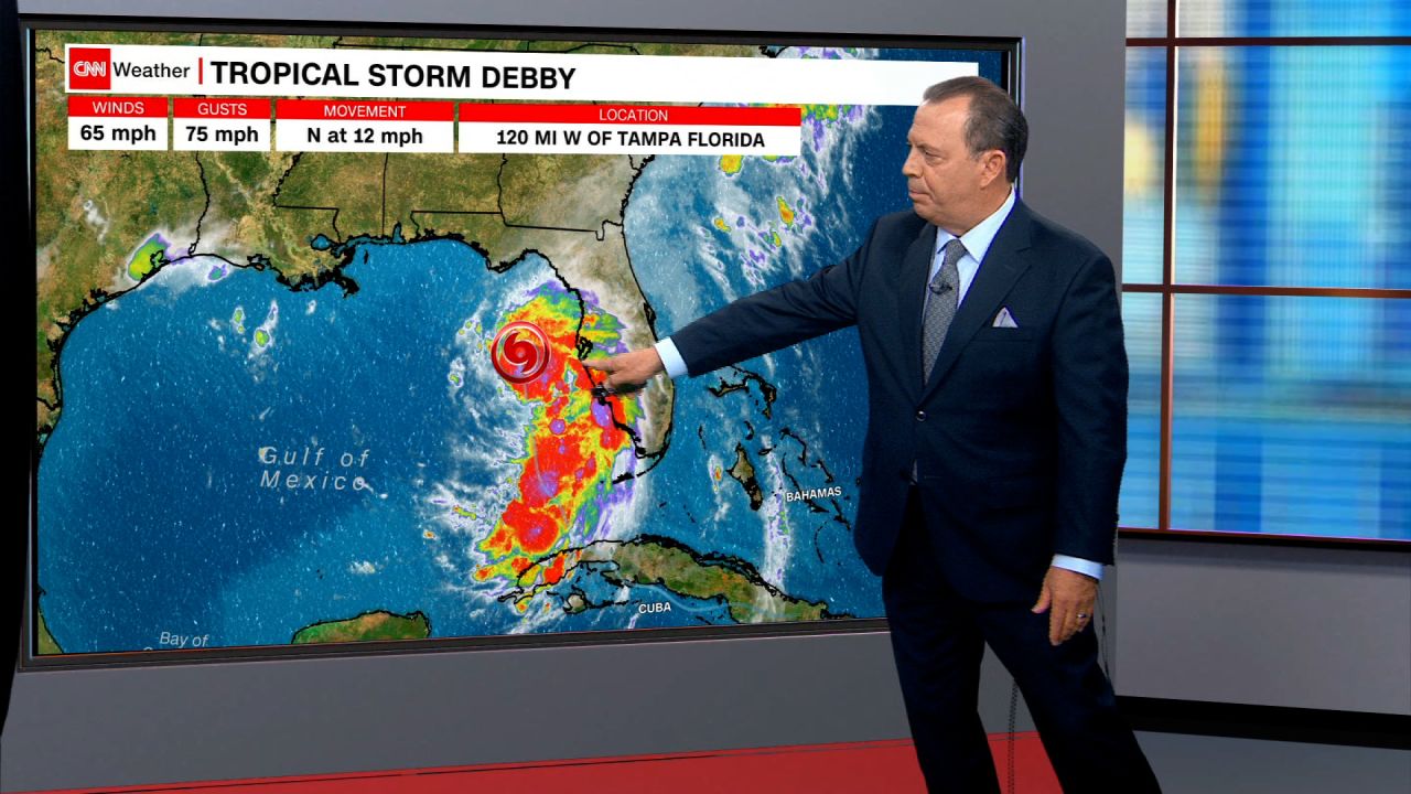
Hurricane Debby, the fourth named storm of the Atlantic hurricane season and the second named hurricane, has become a Category 1 storm, according to the National Hurricane Center.
The storm, located about 100 miles west-northwest of Tampa, Florida, with maximum sustained winds of 75 mph, is expected to strengthen even further before making landfall in Florida’s Big Bend region Monday morning.
“Debby is then expected to move slowly across northern Florida and southern Georgia Monday and Tuesday, and be near the Georgia coast by Tuesday night,” the hurricane center said in its 11 p.m. advisory.
Debby began dumping rain on parts of the state earlier Sunday as a tropical storm and is expected to unload potentially historic amounts of rainfall over the southeastern United States.
Authorities in Florida, Georgia and South Carolina are urging residents to prepare for heavy rain and possible flooding as the storm makes its way through the Gulf.
The cities of Savannah, Georgia, and Charleston, South Carolina, could both be drenched with a month’s worth of rain in a single day — and perhaps even an entire summer’s worth of rain over the course of the storm.
Hundreds of thousands of college and K-12 students will be impacted as several schools in the storm’s projected path have canceled classes Monday, including the University of Florida and Georgia Southern University.
Dangerous conditions had already begun Sunday off Florida’s coast. Two boaters were rescued after their vessel lost its sail amid 15- to 20-foot seas and 50-knot winds, the US Coast Guard in Tampa Bay said.
Debby’s arrival continues to cement an exceptionally early start to the hurricane season after Hurricane Beryl tore through the Caribbean and Texas last month as the earliest Category 5 Atlantic hurricane on record. The second Atlantic hurricane does not occur, on average, until August 26.
Hurricane conditions are expected to arrive by Monday morning, with the outer bands of the storm system making their way on shore during the day Sunday. The storm is forecast to reach the coast of the Big Bend around midday Monday, at which point Debby is expected to then crawl across northern Florida and southern Georgia throughout the day and into Tuesday, the hurricane center said.
The main threat will be flooding, both from storm surges up to 10 feet and heavy rainfall. Freshwater flooding, which is caused by rainfall, has become the deadliest aspect of tropical systems in the last decade, according to research conducted by the hurricane center — a threat made more dangerous as the world warms from fossil fuel pollution.
Track the Storm: Spaghetti models and more maps here
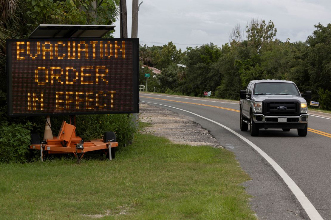
The strengthening storm tracking up the Florida Peninsula’s western coast prompted county and state officials to issue a string of voluntary and mandatory evacuation orders as the hurricane center posted hurricane watches and warnings across several parts of the state, including near Tampa and the Big Bend region.
A hurricane warning has been issued for the Florida Gulf coast from Suwanee River to Yankeetown, the hurricane center said.
Tropical storm and storm surge watches and warnings have also been issued for parts of Florida, coastal Georgia and parts of South Carolina. The hurricane center upgraded a tropical storm watch to a warning for the area west of Indian Pass to Mexico Beach, Florida, in its 5 p.m. ET update, and a tropical storm warning was also issued for the eastern coasts of Florida and Georgia from Ponte Vedra Beach to the Savannah River.
A tornado watch has also been issued for much of the Florida Peninsula and parts of southern Georgia until until Monday morning, covering more than 13 million people, including the cities of Tallahassee, Jacksonville, Tampa and Orlando.
Florida Gov. Ron DeSantis, Georgia Gov. Brian Kemp and South Carolina Gov. Henry McMaster have declared states of emergency for their states in advance of the storm’s arrival. DeSantis on Sunday said in a news conference that he’d activated the Florida National Guard so it would be poised to assist with humanitarian needs as well as search and rescue.

DeSantis called on residents to finish their preparations and to brace for power outages, “particularly in parts of the state like here in Tallahassee.”
“There’s going to be a lot of trees that are going to fall down. You’re going to have debris. You are going to have power interruption,” the governor said, “so just prepare for that.”
More than 78,000 customers were already without power in Florida by Sunday night, according to PowerOutage.us.
DeSantis also urged Florida residents to avoid floodwaters ahead of the storm’s potentially significant flooding impacts, particularly in North Central Florida.
“Please do not drive your vehicles through flooded streets. The number one way we have fatalities as a result of floods is people trying to drive through the floodwater,” he said.
The docks of Indian Mound Park in Sarasota County, south of Tampa, were underwater by 2 p.m. ET Sunday, the county government posted on X. A little farther south, near Fort Myers, waters from the Gulf began spilling over onto coastal roadways and prompted some road closures after Debby’s outer bands dumped rain along the shoreline Sunday afternoon, Charlotte County emergency management officials said.
President Joe Biden on Sunday approved a disaster declaration for Florida, the White House announced, authorizing federal resources to respond to any disaster relief efforts.
Storm expected to intensify over Gulf
The slower Debby moves and the longer it sits over warm waters, the more likely the storm is to intensify. Studies have shown tropical systems are slowing down over time, making them more likely to produce greater rainfall totals over a given area.
Oceans are also getting warmer and supercharging storms, pumping them full of moisture. A 2022 study published in the journal Nature Communications found climate change increased hourly rainfall rates in tropical storms by 5 to 10% and in hurricanes by 8 to 11%.
“Conditions are favorable for strengthening over the Gulf of Mexico with warm sea surface temperatures and light shear. Intensification is likely to be slow during the first 12–24 hours, then proceed at a faster rate after the cyclone develops an organized inner core,” the National Hurricane Center said of Debby.
By early Monday, Debby is expected to move into the Apalachee Bay area of Florida as it moves northward over the Gulf, according to the Weather Prediction Center.
The Apalachee Bay area, which includes parts of Taylor, Jefferson, Wakulla, and Franklin counties, can expect to get drenched with heavy rain from Debby on Sunday, increasing the possibility of flash flooding in several spots, the hurricane center said.
In the meantime, county officials have urged residents in communities along Florida’s Gulf Coast to evacuate ahead of the storm. Mandatory evacuation orders are in effect for parts of Franklin, Citrus and Levy counties, with voluntary orders issued in Hernando, Taylor and Pasco counties.

“I am worried about the aftermath and seeing how much damage we get (and) how we are going to fix it,” Sue Colson, the mayor of Cedar Key in Levy County, told CNN Sunday. The city sits on the island of Way Key in the Gulf of Mexico, about four miles off the coast. She cited high amounts of anticipated rain as well as the threat of storm surge.
“That is always concerning when you are a low-lying island in the middle of the Gulf,” she said.
On Saturday, Florida Highway Patrol knocked on doors to tell residents to consider leaving, Colson said. Residents were continuing to finish their preparations on Sunday morning.
“I think everybody needs to make wise decisions for themselves and not endanger others by endangering yourself,” she said. “If you’re endangering yourself, you are endangering others, because then they have to rescue you.”
Heavy rain could linger for days
As a slow-moving Debby churns along the Georgia-Carolina coastline heading into the new week, it could lead to seemingly endless amounts of rain for days, with totals potentially reaching over 2 feet.
hurricanes: Read more
The heaviest rain amounts could even top 30 inches or more, depending on how long Debby meanders, with some forecast models showing the storm could linger through at least Thursday. “This rainfall will likely result in areas of considerable flash and urban flooding, with significant river flooding expected,” the National Hurricane Center said.
Such exceptional rainfall would challenge state records for rain from a tropical cyclone: In Georgia, the record is 27.85 inches from 1994’s Alberto, while South Carolina’s record is 23.63 inches from Florence in 2018.
A warmer atmosphere holds more moisture and can dump heavier rain. Warmer oceans can fuel stronger hurricanes, packing a punch with higher storm surge thanks to sea-level rise.
With an uptick in the intensity forecast comes an increase in forecasted storm surge, which occurs when ocean water is pushed inland by the onshore winds of a hurricane. Storm surge flooding above ground could rise to 6 to 10 feet along Florida’s Big Bend, and coastal Georgia and South Carolina could see surges reach 2 to 4 feet.
Tampa Bay is expecting 2 to 4 feet of storm surge. Marco Island and other areas of southwest Florida will see 1 to 3 feet of storm surge.
Warmer air and ocean temperatures fueled by human-induced climate change can lead to wetter tropical systems.
The North Florida region nestled between the Panhandle and the rest of the state’s peninsula took a devastating hit last August from Category 3 Hurricane Idalia, and now faces a new threat from Debby.
Editor’s note: Affected by the storm? Use CNN’s lite site for low bandwidth.
CNN’s Robert Shackelford, Allison Chinchar, Elliana Hebert, Raja Razek, Sam Fossum and Melissa Alonso contributed to this report.


