Australia’s jaw-dropping landscapes, from east to west
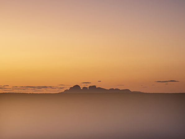
Over the course of two four-month road trips, Lisa Michele Burns drove across Australia and documented its varied landscapes in her new photo book, “Sightlines.” The collection highlights the patterns and palettes of her homeland — like this photo of In the middle of Australia's "Red Center," at the 1,325-square-kilometer (511-square-mile) Uluṟu-Kata Tjuṯa National Park. Look through the gallery to see more jaw-dropping photos of Australia, from east to west.
Lisa Michele Burns
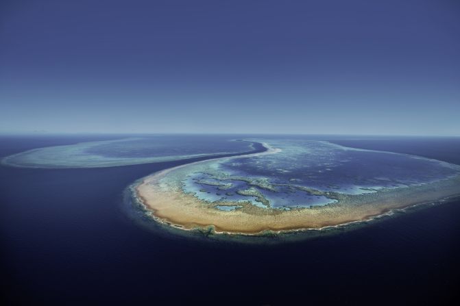
This photo of Hardy Reef in Queensland was one of the few photos in the collection that Burns took before the road trip, while on a helicopter ride over the Great Barrier Reef. "It's one of my favorite shots that I ever took," she says, adding that the conditions that day were just right to capture the deep blue channel against the turquoise shallow reef.
Lisa Michele Burns
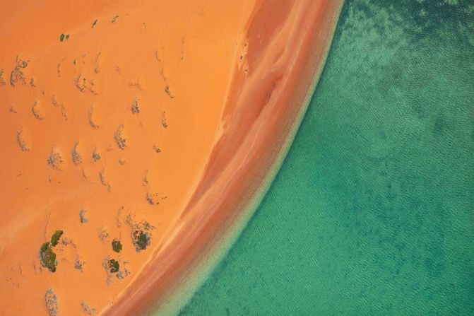
Burns was drawn to vibrant colors and textures, and often photographed sections of landscapes out of context to create abstract vignettes of the environment — like this photo of the contrasting orange dunes and teal water at Francois Peron National Park in Western Australia.
Lisa Michele Burns
K'Gari, formerly known as Fraser Island, is the world's largest sand island and recognized as a UNESCO World Heritage site for its combination of dunes, freshwater lakes, and tall rainforest (pictured), where 50-meter-high trees grow in sand.
Lisa Michele Burns
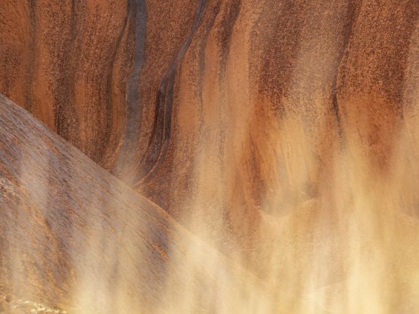
Many of the photos in “Sightlines” focus on details within the landscape, like this image of Uluṟu, where Burns played with light and soft-focus foreground to highlight the golden hues of the sandstone rock and particularly in the flow of the ridges and lines.
Lisa Michele Burns
Listed as a UNESCO World Heritage area for its ecological significance, Shark Bay's shallow waters, salt lakes and coastal dunes are home to 35% of Australia's bird species, as well as marine life, flora and fauna. Burns was captivated by the "sand swirls and tidal patterns," enhanced by shell and coral fragments and high tide, which created deeper shades of blue and sharper contrast with the shallow areas.
Lisa Michele Burns
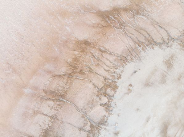
Lake Tyrrell, a salt lake in Victoria, was the first location where Burns used her drone for the project. From the air, Burns was able to capture the "artistic" patterns of the salt crust against the pinkish-gold hues of the soil.
Lisa Michele Burns
James Price Point in Western Australia is a place where "the desert truly meets the sea," Burns writes in her book. She used her drone to capture an unusual perspective of the colorful terrain: red rock, blueish sand and emerald waves.
Lisa Michele Burns
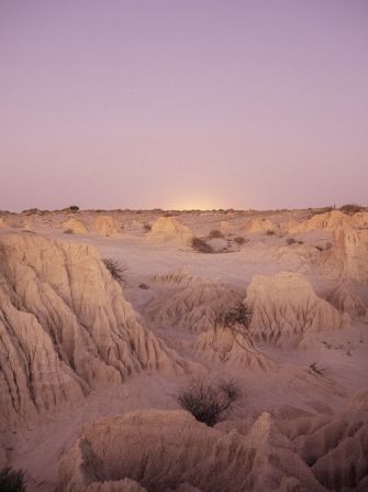
It was gloomy and windy when Burns first arrived at Mungo National Park in New South Wales, but the glow of sunrise painted the rugged landscape of dry lakebeds with an "other-worldly" pastel palette, says Burns.
Lisa Michele Burns
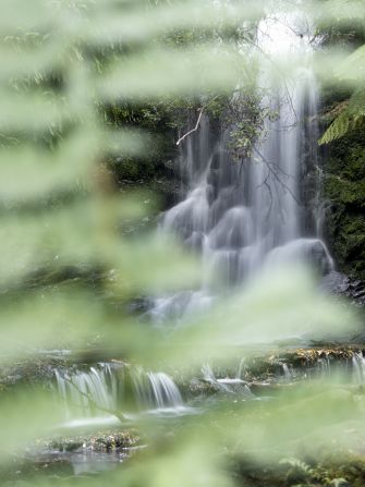
Horseshoe Falls is one of three in Mount Field National Park in Tasmania, the island state that lies 240 kilometers (150 miles) off the coast of Australia.
Lisa Michele Burns
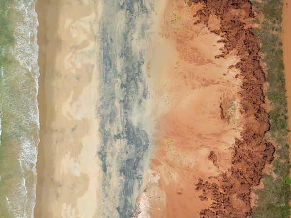
At Roebuck Bay in Western Australia, Burns shot the vibrant red sand, known as "pindan," against the turquoise ocean. The area is rich with biodiversity, says Burns, adding that it provides "feeding grounds for the more than 100,000 migratory shorebirds" each year.
Lisa Michele Burns
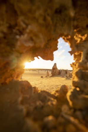
The Pinnacles, pictured, are limestone formations found in a yellow-sand desert reserve in Western Australia. The geological wonders are the result of ancient seashell deposits eroded over millennia, says Burns, who played with different lighting at dawn and sunset to create dramatic images.
Lisa Michele Burns
While driving along the Great Ocean Road — a 243-kilometer-long (150-mile) coastal route in Victoria — Burns stopped at Cape Bridgewater, a viewpoint where she captured swells rolling into the cliffs.
Lisa Michele Burns
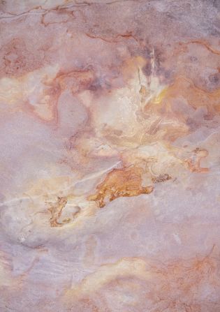
Gantheaume Point is best known for its well-preserved dinosaur footprints — but for Burns, the pastel pink geological formations, known as Broome Sandstone, with unique patterns created by tides and erosion over millions of years, captured her interest.