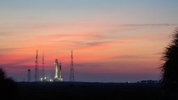
Turn to CNN for live coverage from Kennedy Space Center in Florida, starting on Saturday morning and running through the Monday morning launch. Space correspondents Kristin Fisher and Rachel Crane will bring us moment-by-moment reporting from the launch, along with a team of experts.
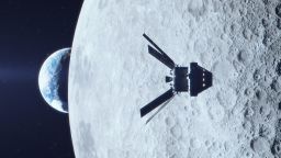
When it comes to launching Artemis I – the next generation of spacecraft to explore the moon and beyond – forecasting the weather is a crucial part of its success.
Meteorologists can accurately forecast up to three days in advance, and even then, things can change. Launch dates that are set weeks to months in advance – such as Monday for Artemis I – can cause forecasters stress.
But launch preparations remain on track for Monday, NASA says, with a 70% chance of favorable weather. A two-hour launch window opens at 8:33 a.m. ET; scattered showers are the biggest concern during that period.
Adverse weather conditions are the most common cause of rocket countdown scrubs, according to meteorologist Mark Burger, the launch weather officer with the US Air Force at Cape Canaveral.
“Roughly 16% of every launch attempt we have at Cape Canaveral gets scrubbed due to weather,” said Burger, who has 23 years of forecast experience. “Roughly 23% of all the countdowns have some sort of weather consideration.”
If any aspect of the weather – temperature, precipitation, lightning, wind and clouds – is unfavorable, Artemis’ launch will be postponed until conditions improve. NASA has announced the next possible launch dates as September 2 and September 5 should the inaugural mission be delayed Monday.
Meteorologists have been working for years for a near-perfect forecast to allow for this mission’s 40,000-mile trip beyond the moon and back to Earth. Plans have included launch weather forecasts, ground operations forecasts, launch weather briefings and even forecasts for emergency landings and end-of-mission plans.

Burger started looking over weather data three years ago, keeping an eye on everything that could possibly delay the Artemis I mission.
“We had a tropical storm that was threatening the area, so they wanted to move some components to sturdier buildings,” he said. “We have a barge that comes and delivers parts for the Artemis mission over the last couple years. We forecast seas and waves all the way from New Orleans to the Cape.”
On launch day and the days preceding it, lightning and cloud cover are the most important to observe, because Florida is known as the lightning capital of North America, according to NASA forecasters.
“It’s more than just simply the lightning bolt that you see yourself, but also the capacity of each cloud to potentially carry a charge when you launch a rocket,” Burger said. “It could trigger lightning on its own.”
A launch could also be scrubbed when thunderstorms are in the vicinity. Sea breezes kick in during the summertime across Florida as well. Any type of cumulus cloud within 10 nautical miles (18.5 kilometers) of the flight path will also inhibit a launch.
“It’s not just the cloud itself but the history of the cloud,” Burger said. “Sometimes going back as far as four hours to producing lightning then could potentially be a no-go situation.”
Forecasters use sensitive radar and modern satellite data.
No one can predict an all clear on Artemis’ launch day on Monday, but Burger said he is realistically hopeful. “It won’t be perfect,” he said. “There are some concerns, but for now we have a fair opportunity to launch.”
Sign up for CNN’s Wonder Theory science newsletter. Explore the universe with news on fascinating discoveries, scientific advancements and more.


