The National Oceanic and Atmospheric Administration issued a La Niña watch on Thursday, which means the agency believes La Niña could form this fall.
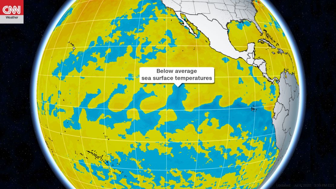
La Niña can cause both more frequent and stronger hurricanes in the Atlantic. Its conditions are characterized by below-normal sea surface temperatures in the tropical Pacific. While sea surface temperatures remained near normal in the Central-Eastern Pacific, they fell below average in the Eastern Pacific last month, NOAA said.

La Niña, much like its warmer counterpart El Niño, has far-reaching global impacts extending beyond the Pacific Ocean. The most impactful characteristic of La Niña in North America is its role in hurricane season.
When El Niño is present, it reduces Atlantic hurricane activity due to increased vertical wind shear – changes in wind speed and direction with height that prevent hurricanes from building.
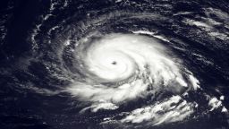
The Atlantic hurricane season generally sees an increase in the number of hurricanes and tropical storms during La Niña due to weaker wind shear and greater atmospheric instability, both of which encourage hurricane formation.
This year’s hurricane season is currently on pace to match the number of named storms during the historic 2005 hurricane season – a season which also saw a La Niña develop in the Autumn.
What exactly is La Niña?
La Niña is the cool phase of the El Niño-Southern Oscillation (ENSO) climate pattern – a naturally occurring phenomenon that involves fluctuating ocean temperatures in the Pacific.
La Niña is the opposite of El Niño, which is the warm phase of the cycle. The two have complementary weather effects.
El Niño is characterized by a warming of the waters in the central and eastern Pacific Ocean. La Niña features a cooling of those same Pacific waters.
A La Niña setup begins when strong, easterly winds blow the top most, warmer layer of water towards Australia and Indonesia, leaving the central-eastern Pacific Ocean as much as four degrees below average.
What are the different impacts of La Niña and El Niño?
This temperature change causes cooler and drier conditions in the Pacific, but affects wind currents in the Atlantic as well. La Niña weakens high atmospheric winds, which allows warm air pockets to grow vertically and develop into hurricanes.
The opposite occurs during an El Niño. In this situation, warming waters cause warm, wet, and hurricane-prone conditions in the Pacific and cool, dry conditions in the Atlantic.
La Niña and climate change
While ENSO events are regular aspects of global weather patterns, increased global temperatures may temper or change their effects.
“La Niña tends to pull down global temperatures, but in recent years we have been warming the planet so fast, it’s like hitting a small speed bump at 80 mph – it barely even registers,” said CNN meteorologist Brandon Miller.
Global temperatures could exceed crucial 1.5 C target in the next 5 years
While it is likely too early to know how climate change will affect ENSO patterns, research is beginning to show how a warming climate may amplify the effects of El Niño and La Niña.
A 2018 study on atmospheric conditions ran simulations of climate conditions and found that climate change could increase the severity of weather events stemming from ENSO patterns.
Outside of any impact on hurricanes, climate change may mean that some older temperature patterns associated with El Niño and La Niña no longer apply.
“2020 is already trending as one of the top 2 warmest years on record. Perhaps a cooling influence from an emerging La Niña will keep it out of the top spot, but will likely still be in the top 3 at least,” Miller said.
“Top spots on the warmest years list used to be reserved for the strong El Niño years, but human influences have long since overwhelmed the planet’s natural temperature regulators.”


