(CNN)Hurricane Ida is expected to rapidly strengthen before pummeling Louisiana on Sunday, forcing evacuations in New Orleans and the surrounding coastal region on the eve of the 16th anniversary of Hurricane Katrina.
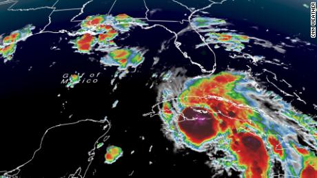
On Saturday, Ida was moving away from Cuba and into the Gulf of Mexico, where it is expected to intensify over the next 24 to 36 hours prior to landfall across the Louisiana coast on Sunday afternoon or evening. Recent satellite imagery showed the storm has already strengthened.
New Orleans Mayor LaToya Cantrell on Saturday warned residents planning to voluntarily evacuate -- which she recommended -- to get out now.
"Time is not on our side. It's just rapidly growing. It's intensifying," the mayor said at a news conference, referring to Ida. "If you're voluntarily evacuating our city, now is the time to leave -- you need to do so immediately. If you're planning to ride it out, again, make sure that you're able to hunker down."
Louisiana Gov. John Bel Edwards said Ida "will be one of the strongest hurricanes that hit anywhere in Louisiana since at least the 1850s."
"This is a very large storm," Edwards told reporters Saturday, noting that the hurricane could span about 150 miles east and west from the storm's center.
"I don't want folks who are further inland to be caught off guard."
Over 4,000 soldiers and airmen with the Louisiana National Guard are currently mobilized and another 5,000 will be prepared by the time the storm makes landfall, Edwards told CNN Saturday afternoon.
"You just have a few more hours really to prepare," Edwards said.
"Where you go to bed tonight, you need to be prepared to ride out the storm and the storm is going to be very severe," he told those who are not evacuating.
'An extremely dangerous major hurricane'
Ida is anticipated to reach at least Category 4 strength before landfall, the National Hurricane Center said, maintaining its earlier forecast. Tropical storm-force winds could reach New Orleans about 8 a.m. Sunday before the storm makes landfall that afternoon or evening west of New Orleans, near Houma and Morgan City. Late Saturday afternoon, meteorologists at the center said the storm appears to have begun its intensification phase.
Hurricane Ida remains a Category 2 hurricane with winds of 105 mph with stronger gusts, according to the 11 p.m. National Hurricane Center update. Rapid strengthening is forecast during the next 12 to 24 hours and Ida is expected to be an extremely dangerous major hurricane when it makes landfall along the Louisiana coast on Sunday.
"Ida is expected to be an extremely dangerous major hurricane when it approaches the northern Gulf Coast on Sunday," National Hurricane Center forecasters said Saturday morning. At 2 p.m. ET, the storm had strengthened to a Category 2 hurricane with winds of 100 mph.
Officials throughout the state implored people to evacuate, with some issuing mandatory orders to do so. News footage from the area showed traffic backed up heading out of New Orleans.
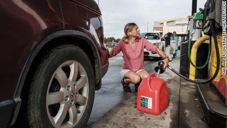
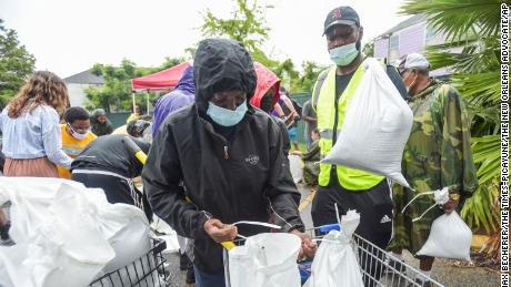
Collin Arnold, director of the New Orleans Office of Homeland Security and Emergency Preparedness, urged people to stock up on enough food and water for at least three days -- and to be either on the road or home by midnight.
"We say the first 72 (hours) is on you," Arnold added. "The first three days of this will be difficult for responders to get to you."
In text alerts Saturday, New Orleans officials urged residents to "leave by this morning if you can."
"If you're staying, gather supplies, charge devices, lower fridge temp & secure outdoor items today," the message said.
State officials also texted residents: "Get ready for Ida."
"Louisianans have until nightfall," the text warned, adding that Ida will "bring serious impacts across the state."
Cantrell issued a mandatory evacuation of all city areas that are outside its flood protection system, and urged other residents to evacuate voluntarily or shelter in place.
"The city cannot issue a mandatory evacuation because we don't have the time," Cantrell said Friday at a news conference, speaking about areas inside the levee system. "We do not want to have people on the road, and therefore, in greater danger because of the lack of time."
A dangerous storm surge of 10 to 15 feet is expected from Morgan City, Louisiana, to the mouth of the Mississippi River on Sunday as Ida makes landfall, the NHC said.
The storm surge, coupled with winds as strong as 150 mph, could leave some parts of southeast Louisiana "uninhabitable for weeks or months," according the to the latest hurricane statement from the National Weather Service in New Orleans.
The statement warned of "structural damage to buildings, with many washing away" as well as winds that could bring "widespread power and communication outages." Flooding rains could cause "numerous road and bridge closures with some weakened or washed out" along with "some structures becoming uninhabitable or washed away."
Hurricane conditions are likely in areas along the northern Gulf Coast beginning Sunday, with tropical storm conditions expected to begin by late Saturday night or early Sunday morning. These conditions will spread inland over portions of Louisiana and Mississippi Sunday night and Monday.
Mississippi Gov. Tate Reeves declared a state of emergency on Saturday.
Rainfall can amount to 8 to 16 inches, with isolated maximum totals of 20 inches possible across southeast Louisiana and southern Mississippi through Monday-- which will likely lead to significant flash and river flooding impacts.
A hurricane warning remains in effect from Intracoastal City, Louisiana, to the mouth of the Pearl River and includes Lake Pontchartrain, Lake Maurepas and New Orleans.
In Louisiana, a tropical storm warning was in effect from Cameron to west of Intracoastal City and the mouth of the Pearl River to the Mississippi-Alabama border. Tropical storm warnings and watches are also issued stretching east to the Alabama-Florida border.
The storm has already idled about 90% of the oil production 84% of gas production in the Gulf of Mexico, according to the Bureau of Safety and Environmental Enforcement.
Mandatory evacuations were ordered for parts of at least seven Louisiana parishes as well as the towns of Grande Isle and Port Fourchon. Voluntary evacuations were issued in six parishes.
Jefferson Parish President Cynthia Lee Sheng urged residents in low-lying areas to immediately evacuate before Hurricane Ida hits, as the expected storm surge is "unsurvivable."
"I want to reiterate the storm surge that we are expecting is unsurvivable," she said, adding that the storm is expected to linger over the area. "We need you to leave immediately."
Jefferson Parish Sheriff Joseph Lopinto said if people want to leave, they should go now, but once the storm starts, they need to stay off the roads to protect first responders.
Anyone who cannot live without power for days or possibly weeks due to a medical condition should evacuate now before the storm starts, Sarah Babcock, the chief administrative assistant for Jefferson Parish, said.
New Orleans is anticipating impacts from damaging winds of up to 110 mph, according to Arnold.
"If you are going to evacuate, you know that's a responsibility that you take on -- do so as soon as possible," he said. "You do not want to be stuck on the road, when the storms impacts arise."
If Ida makes landfall in Louisiana, it would be the fourth hurricane to do so since last August and Louisiana's third major hurricane landfall in that span.
Sunday, which is the forecast landfall day, is also the 16th anniversary of Hurricane Katrina, a devastating Category 3 storm with winds near 127 mph that caused severe flooding to cities along the Gulf Coast, from New Orleans to Biloxi, Mississippi. More than 1,800 people were killed in the Gulf region directly or indirectly from the storm and in the days after, according to a NOAA report.
"August 29 is an important date in history here," Collins told CNN Saturday. "A lot of people remember what happened 16 years ago. It's time to hunker down tonight and be where you need to be."
In Washington, an administration official told CNN that President Joe Biden is "being briefed regularly on the storm's trajectory." Biden spoke with the governors of Louisiana, Alabama and Mississippi on Friday.
At a briefing Saturday with FEMA Administrator Deanne Criswell, Biden urged those in the path of Hurricane Ida "to pay attention and be prepared."
"This weekend is the anniversary of Hurricane Katrina, and it's a stark reminder that we have to do everything we can to prepare the people in the region to make sure we're ready to respond," Biden said.
Ida raises health concerns amid Covid-19 pandemic
Hospitals in New Orleans will not evacuate and instead shelter in place while Ida makes its way through the region, the city's health department director Dr. Jennifer Avegno said.
Capacity at nearby hospitals in Texas and Florida is "extremely limited," Avegno said, as Covid-19 hospitalizations are on the rise. She added that the city's hospitals are familiar with plans during storm season.
"I would ask our residents, if you do not need to go to the hospital this weekend, if you do not have a life-threatening emergency, please do not go," Avegno said. "This is not the time to go to the hospital for a routine thing that could wait until later."
Meanwhile, Louisiana had no plans Friday to separate vaccinated and unvaccinated people in shelters in state assisted emergency facilities during Ida, according to Mike Steele, a spokesperson for the state Homeland Security and Emergency Management.
Steele noted that municipalities issue evacuation orders, and those operations start at the local level. He added that masks are required at all shelters in the state along with social distancing.
Louisiana Gov. John Bel Edwards expressed concern about sheltering while Covid-19 are on the rise in the state.
"The prospect of sheltering potentially thousands and thousands of people at the height of the fourth surge is very, very daunting," he said during a news conference about hurricane recovery efforts.
The governor acknowledged the challenge of bracing for a potential hurricane in the midst of recovery efforts from the 2020 hurricane season.
"We're not recovered. Not by a long shot," the governor said of Hurricanes Laura and Delta impacts last year. "We still have businesses boarded up from the last (hurricane.) Homes have not yet been repaired and reoccupied. Or if they are damaged to the point where they need to be demolished and removed, in many cases that hasn't happened either."
Edwards said there are currently 2,450 people hospitalized with Covid-19, more than "at any point before this current surge."
"We had four hurricanes last year during Covid, but we had a small fraction of the number of people in our hospitals that we currently have," Edwards told CNN Saturday. "When Hurricane Laura hit last year, we only had about 300 in the hospitals."
Evacuating hospitals is not an option because there is "no excess capacity anywhere else in the state or outside the state," he said.
Officials are concerned not only that hospitals could face prolonged power outages, but also worry about what capacity they would have for those who might be injured during the hurricane, according to Edwards.
Ida made two landfalls in Cuba Friday
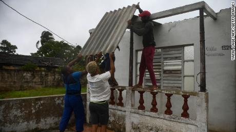
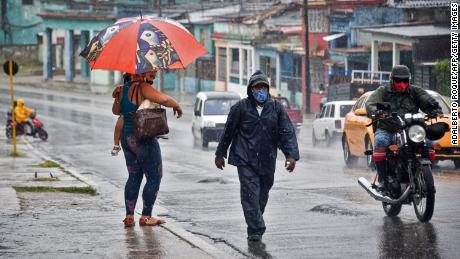
Before entering the Gulf, Ida made landfall twice over Cuba as a Category 1 hurricane.
First forming as a tropical storm in the Caribbean on Thursday, Ida hit Cuba's Isla de la Juventud, or Isle of Youth, on Friday afternoon, the US National Hurricane Center said.
A second landfall occurred in western Cuba around 20 miles (30 km) east of La Coloma, according to satellite images, radar data and NOAA Hurricane Hunter data.
More than 4 inches of rain were recorded in Pinar del Rio, according to the Cuban Meteorological Institute. Jag├╝ey Grande Matanzas experienced around 2.4 inches of rain and the Isle of Youth had 1.89 inches, the institute said. Havana recorded 0.94 inches.
Isolated instances of 5 to 15 inches of rain in some parts of western Cuba are expected, according to hurricane center forecasters.
"These rainfall amounts may produce life-threatening flash floods and mudslides," the hurricane center said. Swells generated by Ida are expected to affect the western part of the island through Saturday morning.


