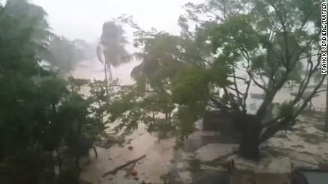
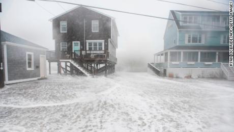
(CNN)Hurricane Ida whipped western Cuba on Friday and the Category 1 storm is expected to slam the US Gulf Coast as an even stronger cyclone Sunday, putting states from Louisiana to Florida on alert for fierce destruction.
Ida briefly will reach Category 4 strength before striking the southern Louisiana coast Sunday evening as a Category 3 storm, forecasters at the National Hurricane Center said.
"Ida is expected to be an extremely dangerous major hurricane when it approaches the northern Gulf coast on Sunday," the hurricane center noted.
Leaders in Louisiana and elsewhere issued mandatory or voluntary evacuation orders Friday in anticipation of major damage.
In New Orleans, Mayor LaToya Cantrell issued a mandatory evacuation of all city areas that are outside its flood protection system, as well as a voluntary evacuation alert for the rest of the parish.
New Orleans is part of an area where a storm surge could combine with high tide to send 11 feet of water onshore Sunday, the National Hurricane Center said.
"We are activating every single resource at our disposal, so that we are prepared to respond," Cantrell said Friday.
The mayor urged residents to have hurricane preparations in place by Saturday afternoon. "Do not wait," she said.
Later she announced that the National Weather Service and Governor John Bel Edwards have indicated there is no time for implementing contraflow traffic so there won't be new mandatory evacuations.
"The situation is much more serious than it was six hours ago, and the hurricane, it represents a dramatic threat to the people of the city of New Orleans. Time is not on our side," Cantrell said.
According to Collin Arnold, director of the New Orleans Office of Homeland Security and Emergency Preparedness, the city is anticipating impacts from damaging winds up to 110 miles an hour.
"If you are going to evacuate, you know that's a responsibility that you take on -- do so as soon as possible," he said. "You do not want to be stuck on the road, when the storms impacts arise."
If Ida makes landfall in Louisiana, it would be the fourth hurricane to do so since last August -- and would be Louisiana's third major hurricane landfall in that span.
Ida, which formed as a tropical storm in the Caribbean on Thursday, made landfall Friday afternoon on Cuba's Isle of Youth, or Isla de la Juventud, the US National Hurricane Center said.
The center of the storm will cross the western portion of Cuba and could cause life-threatening flash floods there and the Cayman Islands, forecasters said.
After that, it is expected to strengthen in the Gulf of Mexico ahead of a US landfall on Sunday night -- 16 years to the day that Hurricane Katrina made landfall in Louisiana.
"Wind damage and storm surge will be life-threatening from Louisiana to the Florida Gulf Coast. Residents should also prepare for long-duration power outages," CNN meteorologist Chad Myers said Friday.
President Biden on Friday approved an emergency declaration for Louisiana and ordered federal help for the state.
Evacuation orders posted across parts of Gulf Coast
Evacuation orders and advisories were issued across parts of Louisiana and Mississippi on Friday ahead of the storm.
Besides the alerts issued in New Orleans, similar orders or advisories were issued in nearby communities.
Plaquemines Parish, situated just south of New Orleans, said evacuations would be mandatory starting at 3 p.m. Friday for the entire eastern bank of the Mississippi River, and much of the western bank.
The Louisiana barrier island town of Grand Isle, also south of new Orleans, ordered evacuations, too.
Lafourche, St. Charles and Terrebonne parishes each issued evacuation orders on Friday.
St. Mary Parish issued a mandatory evacuation for residents south of the Intercoastal Waterway and a voluntary evacuation for the rest of the parish, according to a post on the sheriff department's Facebook page.
While not ordering evacuations, officials in St. Bernard Parish urged residents to finalize preparations.
"So we need to know that this is going to be a terrible storm, we need to know that we need to hunker down by tomorrow afternoon, and you need to be where you're going to be for the duration of this storm," Parish President Guy McInnis said.
On Thursday evening, the National Park Service issued a mandatory evacuation order for the Fort Pickens, Florida, and Davis Bayou, Mississippi, campgrounds in the Gulf Islands National Seashore.
Oil and gas companies have evacuated dozens of production platforms in the Gulf of Mexico as Hurricane Ida looms, knocking offline more than half the region's crude production, regulators said Friday.
The Bureau of Safety and Environmental Enforcement estimates that about 58.5% of the current oil production in the Gulf of Mexico has been shut down. The agency said nearly 49% of the natural gas production in the region has similarly been sidelined.
Ida whipped Cuba and the Cayman Islands on Friday
As of 11 p.m. ET Friday, Ida's center was 615 miles southeast of New Orleans after crossing western Cuba, with sustained winds of 80 mph.
Before it headed to the Gulf, Ida delivered potentially dangerous amounts of rain to Cuba, the National Hurricane Center said.
Ida could deliver 5 to 15 inches of rain to western Cuba, including the Isle of Youth, hurricane center forecasters said.
"These rainfall amounts may produce life-threatening flash floods and mudslides," the hurricane center said.
Dangerous storm surge, winds and rain possible for US Gulf Coast
Rapid intensification will happen in the Gulf on Saturday and Sunday, forecasters said.
"The global models show a very favorable upper-level wind pattern over the storm and abundant environmental moisture," the hurricane center said. "These conducive atmospheric conditions combined with very warm Gulf of Mexico waters should allow Ida to rapidly intensify this weekend."
Some of the storm's outer bands could reach the northern Gulf Coast by late Saturday, but tropical storm force winds won't arrive until Sunday morning.
Winds, storm surge and heavy rain are expected to be major threats.
As for storm surge: Water reaching 10 to 15 feet above ground could move ashore if surge and high tide combine in an area from Morgan City, Louisiana, to the mouth of the Mississippi River, the hurricane center said.
About 8 to 20 inches of rain are possible from southeast Louisiana to coastal Mississippi and Alabama through Monday morning, the hurricane center said.
After landfall, Ida could turn northeast as it moves inland. About 4 to 8 inches of rain are possible across southern and central Mississippi into the Tennessee Valley, the hurricane center said.
"This is likely to result in considerable flash and riverine flooding impacts," the hurricane center said.
A hurricane warning is in effect for Intracoastal City, Louisiana, to the Mouth of the Pearl River and for Lake Pontchartrain, Lake Maurepas, and metropolitan New Orleans.
A hurricane watch was in effect Friday for these parts of the US: Cameron, Louisiana, to west of Intracoastal City, and for the mouth of the Pearl River to the Mississippi/Alabama border.
A storm surge watch was issued Friday for Sabine Pass, Texas, to the Rockefeller Wildlife Refuge in Louisiana and for Mobile Bay.
Louisiana prepares for another hurricane
Louisiana has been hard hit by hurricanes in the last year.
Two major hurricanes made landfall in the state in 2020: Laura as a Category 4 in August, and Zeta as a Category 3 in October. Zeta initially was thought to be a Category 2 storm when it hit, but a subsequent data review showed that it was Category 3 strength at landfall.
Hurricane Delta also slammed into the state in October as a Category 2 storm.


